Back to search results
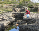
PRINCE OF WALES CO. NO. 3
MILES STREET SEBASTOPOL, BALLARAT CITY
PRINCE OF WALES CO. NO. 3
MILES STREET SEBASTOPOL, BALLARAT CITY
All information on this page is maintained by Heritage Victoria.
Click below for their website and contact details.
Victorian Heritage Inventory
On this page:
Statement of Significance
What is significant?
How is it significant?
Why is it significant?
Show more
Show less
-
-
-
-
BONSHAW CO
 Victorian Heritage Inventory
 -
PRINCE OF WALES
Victorian Heritage Inventory
-
208 Grant Street
 Ballarat City
-
-