-
Save Search
You must log in to do that.
-
Share Search
-
Download Search
The download will only include records from the current search page. You can increase the number of records to download by changing the number of 'listings per page' at the bottom of this page. Note that the maximum number of records that can be listed per page is 300. The download may exceed the number of records listed as any 'nested' records that have met the search criteria will also download.
Download file (.xls)
Success
Error
-
Save Search
You must log in to do that.
-
Share Search
-
Download Search
The download will only include records from the current search page. You can increase the number of records to download by changing the number of 'listings per page' at the bottom of this page. Note that the maximum number of records that can be listed per page is 300. The download may exceed the number of records listed as any 'nested' records that have met the search criteria will also download.
Download file (.xls)
-
SKIDMORE ROAD BEECHWORTH, INDIGO SHIRE

Victorian Heritage Register
VHR H0357The Powder Magazine at Beechworth, including the stone magazine built in 1859 and the surrounding walls built in 1860. History Summary The Powder Magazine at Beechworth was constructed in…
-
100 VINCENT STREET DAYLESFORD, HEPBURN SHIRE

Victorian Heritage Register
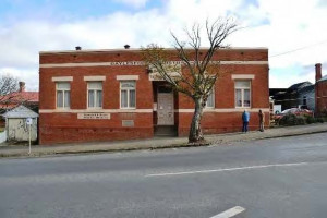
VHR H2434The Daylesford School of Mines comprises the Laboratory Building with Chimney and the Art Department Building dating from 1890, and the Technical School Addition of 1914. Both the…
-
22-48 CHUM STREET GOLDEN SQUARE, GREATER BENDIGO CITY

Victorian Heritage Register
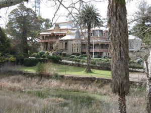
VHR H2211Fortuna is a picturesque nineteenth century villa and garden developed from 1857 by two of Australia's wealthiest gold magnates, Christopher Ballerstedt from 1854 and George Lansell after…
Also listed in:
-
THOMSON RIVER DIVERSION TUNNEL SITE
THOMSON RIVER WALHALLA, BAW BAW SHIRE

Victorian Heritage Register
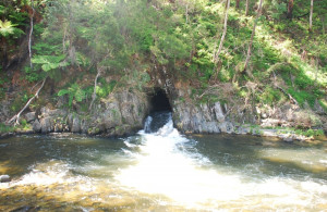
VHR H1990The Thomson River Diversion Tunnel Site including the 220 metre tunnel through Stockriders Spur, the 1.2km section of river bed known as Horseshoe Bend between the tunnel's inlet and outlet,…
-
NUGGETTY TRACK STONY CREEK, CENTRAL GOLDFIELDS SHIRE

Victorian Heritage Register
VHR H2341The Stony Creek School Reserve, located in the Talbot State Forest approximately 7 kms southwest of Talbot. It contains the archaeological remains of the 1869 Stony Creek School House and…
-
STAWELL AMALGAMATED MINERS' ASSOCIATION BANNER
59-69 MAIN STREET STAWELL, NORTHERN GRAMPIANS SHIRE

Victorian Heritage Register
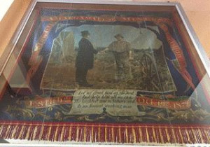
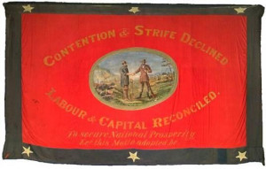
VHR H2383The Stawell AMA Banner. HOW IS IT SIGNIFICANT? The Stawell AMA Banner is of historical significance to the State of Victoria. It satisfies the following criteria for inclusion in the…
-
GOLDEN POINT ROAD GOLDEN POINT, MOUNT ALEXANDER SHIRE

Victorian Heritage Register
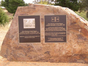
VHR H2368History Summary In the first week of July 1851, Victoria separated from New South Wales and became a colony in its own right. In the same week, gold was discovered in the new colony.…
-
GREAT ALPINE ROAD HARRIETVILLE, ALPINE SHIRE

Victorian Heritage Register
VHR H2356The Sambas Gold Mine including abandoned and working mining infrastructure and archaeological remains. Above ground infrastructure includes a battery shed and gold retrieval plant, and a…
-
14-20 DELANY AVENUE BRIGHT, ALPINE SHIRE

Victorian Heritage Register
VHR H2370The Bright Chinese Camp including archaeological features, deposits and relics. History Summary Gold was discovered in the new Colony of Victoria in 1851 and by the end of 1854, some 200,000…
-
BANNER OF THE AMALGAMATED MINERS' ASSOCIATION OF AUSTRALASIA - MALDON NO. 14 BRANCH
93 HIGH STREET MALDON, MOUNT ALEXANDER SHIRE

Victorian Heritage Register
VHR H2384The Banner of the AMAA, Maldon No. 14 Branch. HOW IS IT SIGNIFICANT? The Banner of the AMAA, Maldon No. 14 Branch is of historicalsignificance to the State of Victoria. It satisfies the…
-
OLD LEAD ROAD AND OLD LEAD ROAD DUNOLLY, LODDON SHIRE, CENTRAL GOLDFIELDS SHIRE

Victorian Heritage Register
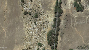
VHR H2402The Old Lead Diggings, Dunolly includes a dense aggregation of several thousand remnant mining shafts that resulted from the search for nuggety gold. The place contains other archaeological…
Also listed in:
-
O'DELL'S TRACK BROOKVILLE, EAST GIPPSLAND SHIRE

Victorian Heritage Register
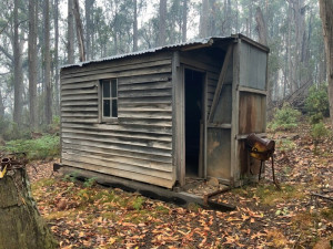
VHR H2411O’Dell’s Hut is a single room, portable hut located on Odells Track in Brookville, East Gippsland. It is of a modest size and simple form with timber stud, weatherboard clad walls and…
-
113 Albert Street, SEBASTOPOL VIC 3356 - Property No 2000189

Ballarat City
The MUIOOF Lodge (former South Star Gold Mine No. 1 Offices), located at 113 Albert Street Sebastopol, to the extent of the fabric dating between c1886 and 1909. The Lodge is a long, narrow…
-
Former Prince of Wales and Bonshaw Company gold mining site and mine managers residence
362 Albert Street SEBASTOPOL, BALLARAT CITY

Ballarat City
The former Prince of Wales and Bonshaw Company gold mining site and mine managers residence at 362 Albert Street, Sebastopol dates from the mid 1860s and was the third site of the Prince of…
-
Clontarn (former South Star Mine managers house)
122 Albert Street, SEBASTOPOL VIC 3356 - Property No 2000500

Ballarat City
The former South Star Mine Manager's residence, located at 122 Albert Street Sebastopol, built in two distinct stages in the nineteenth century. The first stage of the single storey…
-
363, 365-9, 371, 373, 375 & 377-9 Albert Street SEBASTOPOL, BALLARAT CITY

Ballarat City
Cornish Row Heritage Precinct comprises all of the buildings, all of the land and all of the mature plantings at 363, 365-369, 371, 373, 375 and 377-379 Albert Street, Sebastopol as well of…
-
Albert St, Birdwood Ave, Charlotte St, Victoria St, Walker St, Wilsons Lne, Yarrowee St SEBASTOPOL, BALLARAT CITY

Ballarat City
The Timber Mining Cottage Series is located in Albert Street, Birdwood Avenue, Charlotte Street, Walker Street, Wilsons Lane, Victoria Street and Yarrowee Street Sebastopol. They are on…
-
Late Victorian Timber Residence Series
77, 102, 155, 160, 168, 193, 208, 230, 240, & 280 ALBERT STREET, 140 BEVERIN STREET, 3 BRIDGE STREET, 100 & 114 GRANT STREET, 1 & 7 KENT STREET, 101 & 103 VICKERS STREET, AND 62 & 73 YARROWEE STREET, SEBASTOPOL, BALLARAT CITY

Ballarat City
The houses of the Late Victorian Timber Residence Series as described are located in Albert Street, Beverin Street, Bridge Street, Grant Street, Kent Street, Vickers Street and Yarrowee…
-
15 ROSEMUNDY ROAD, EPSOM - PROPERTY NUMBER 203261, GREATER BENDIGO CITY

Greater Bendigo City
Rosemundy House is a substantial and evolved single-storey Italianate red brick and stuccoed house. It was built in multiple stages from 1858. As originally built, a weatherboard factory was…
-
9 Kawana Drive and 24A Pioneer Drive MAIDEN GULLY, GREATER BENDIGO CITY

Greater Bendigo City
The Ninnes Lone Grave and Reserve is surrounded by modern housing development. The grave itself is enclosed by a stone wall, measuring approximately 3m x 2.5m and rising to 0.9m at its…
-
51 Andrews Road, MAIDEN GULLY VIC 3551 - Property No 198946

Greater Bendigo City
Byronsvale (previously Turand) is located on Andrews Road to the south of Maiden Gully, and is accessed via a driveway from Andrews Road. The property includes the main north-facing house,…
-
FORMER SHAMROCK HOTEL AND STORE
63 WHEWELL STREET, NEILBOROUGH - PROPERTY NUMBER 201120, GREATER BENDIGO CITY

Greater Bendigo City
The former Shamrock Hotel and Store, built c. 1904, is located at the corner of Whewell and Miller streets, Neilborough. It is a substantial single-storey Federation-era brick building with…
-
3536 ELMORE-RAYWOOD ROAD, AND 3536-3538 ELMORE-RAYWOOD ROAD, RAYWOOD - PROPERTY NUMBERS 215807, 209241, GREATER BENDIGO CITY

Greater Bendigo City
The former McKay farmhouse consists of two elements: the original c. 1864 component, facing Oxleys Road to the west, and a weatherboard addition to the south, which is believed to have been…
-
102 Main Street, SEBASTIAN VIC 3556 - Property No 201020

Greater Bendigo City
Statement of Significance The Little Sebastian Hotel, built 1879-80, is a symmetrical single-storey hotel of bi-chrome brick construction located on Sebastian's main street, opposite the…
-
Francis Harritable's log buildings (ruins)
CA 3A Rothackers Road, WOODVALE VIC 3556 - Property No 198143

Greater Bendigo City
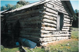
Statement of Significance The surviving structures at the Harritable property are two log stores and a log dwelling. All are built of Cypress Pine. The stores are gable roofed log…

