-
Save Search
You must log in to do that.
-
Share Search
-
Download Search
The download will only include records from the current search page. You can increase the number of records to download by changing the number of 'listings per page' at the bottom of this page. Note that the maximum number of records that can be listed per page is 300. The download may exceed the number of records listed as any 'nested' records that have met the search criteria will also download.
Download file (.xls)
Success
Error
-
Save Search
You must log in to do that.
-
Share Search
-
Download Search
The download will only include records from the current search page. You can increase the number of records to download by changing the number of 'listings per page' at the bottom of this page. Note that the maximum number of records that can be listed per page is 300. The download may exceed the number of records listed as any 'nested' records that have met the search criteria will also download.
Download file (.xls)
-
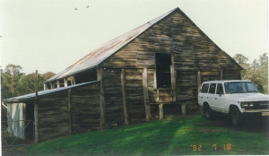
1394 HEIDELBERG-KINGLAKE ROAD ST ANDREWS, NILLUMBIK SHIRE

Nillumbik Shire
REVISED STATEMENT OF SIGNIFICANCE, CONTEXT, 2010 The late 19th century/early 20th century drop-slab barn, and the surrounding site to a radius of 50 metres How is it significant?The late 19th…
-
HO105 - Mt Cottrell Road Stock Yard, Ruins and Dry Stone Walls
1476-1570 Mount Cottrell Road MOUNT COTTRELL, Melton Shire

Melton City
H7822-0141The ruin, dry stone walls and sheep yards at 1476-1570 Mt Cottrell Road are an extensive, substantially intact, and unusual complex of dry stone walls, and stone farmhouse ruins and plantings…
-
901 HEIDELBERG-KINGLAKE ROAD HURSTBRIDGE, NILLUMBIK SHIRE

Nillumbik Shire
REVISED STATEMENT OF SIGNIFICANCE, CONTEXT, 2010 The entire c1894 house, including later extensions and the front and back gardens and the surrounding site to the title boundaries. Trees of…
-
PRE-CAST CONCRETE HORSE TROUGH AT ROAD RESERVE, 1522 MAIN RD, RESEARCH
1522 MAIN RD RESEARCH, NILLUMBIK SHIRE

Nillumbik Shire
REVISED STATEMENT OF SIGNIFICANCE, CONTEXT, 2010 The early 20th century trough and the surrounding site to a radius of 10 metres. How is it significant? The trough is historically and…
-
Arundel Road, KEILOR VIC 3036 - Property No 87

Brimbank City
Individual place statement of significance:: Frank and Mary Milburn's Glenburn Farm is of local historical significance as a representative surviving example of a late nineteenth century…
-
RMB 8720 Morgiana Road, WANNON VIC 3301 - Property No 2021200

Southern Grampians Shire
The garden and orchard of Wannon Lea surround a typical early late nineteenth or early twentieth century weatherboard farmhouse. The garden is sited adjacent to the Morgiana Road,…
-
Pigeon Ponds Road PIGEON PONDS, Southern Grampians Shire

Southern Grampians Shire
Fairview, Pigeon Ponds Road, Pigeon Ponds is a small homestead complex comprising a dwelling, a detached kitchen, a range of outbuildings and a woolshed. The land seems to have been taken up…
-
Green's Lane HARROW, West Wimmera Shire

Southern Grampians Shire
Carrigeen Homestead Complex is located at the end of a long drive with terminal turning circle, off Greens Road, some three kilometers south east of Harrow. The complex is made up of a large…
-
Mirranatwa School Road MIRRANATWA, Southern Grampians Shire

Southern Grampians Shire
The ruined house and outbuilding are located on the north side of the Mirranatwa School Road, in the hamlet of Mirranatwa. The ruined house is of timber, and dates from the late nineteenth…
-
Coleraine-Balmoral Road, KONONG WOOTONG VIC 3315 - Property No 1590

Southern Grampians Shire
Myrniong is a deliberately asymmetrical brick house constructed on a steep slope over two levels. The house is located on the west side of the Coleraine - Balmoral Road overlooking the…
-
Hamilton Highway and Day's Lane TABOR, Southern Grampians Shire

Southern Grampians Shire
Virginia is a bluestone homestead with later timber additions, located on the corner of Day's Lane and the Hamilton Highway, about 6.5km north west of the township of Penshurst. Virginia was…
-
HO16 - House, 2-200 Porteous Road, Toolern Vale
2-200 Porteous Road TOOLERN VALE, Melton Shire

Melton City
The house at 2-200 Porteous Road, Toolern Vale, formerly 'Braemar', is significant as a predominantly intact example of an Edwardian style built c.1900-1910, and for its association with the…
-
HO50 - Former Clarke Dam, Diggers Rest - Coimadai Road, Diggers Rest
544-618 Diggers Rest-Coimadai Rd DIGGERS REST, Melton Shire

Melton City
H7822-0147The former Clarke Rockbank station dam at 544-618 Diggers Rest - Coimadai Road, Diggers Rest is significant as a rare and the third largest known drystone wall private pastoral dam in…
-
HO119 - House, 107-121 Water Reserve Road, Rockbank
107-121 Water Reserve Road GRANGEFIELDS, MELTON CITY

Melton City
The house at 107-121 Water Reserve Road, Rockbank, is significant as a moderately-intact example of a Edwardian style with interwar styled windows. This dwelling represents one of three…
-
250 JEETHO ROAD, JEETHO, SOUTH GIPPSLAND SHIRE

South Gippsland Shire
The former 'Wrigwell', later known as 'Glenorchy', at 250 Jeetho Road, Jeetho is significant. The following buildings and other features contribute to the significance of the…
-
221 TALISKER HOMESTEAD ROAD, MERINO, GLENELG SHIRE

Glenelg Shire
Talisker Homestead Complex, Talisker Homestead Road, Merino was built for the grazier, Alexander Magnus McLeod (1846-1910) and his wife Caroline in 1901. Talisker was a sub-division of…
-
8-10 Bailey Road,NARRE WARREN NORTH, Casey City

Casey City
'The Grattons', comprising the homestead constructed c.1900 and remnant orchard plantings, at 8-10 Bailey Road, Narre Warren North. How is it significant? 'The Grattons' is of local…
