Cape Bridgewater
CAPE BRIDGEWATER VIC 3306 - Property No L10143


Statement of Significance
The geological history of the area (volcanic and recent sedimentary) is the basis of a landscape of dramatic coastal forms and subtle hinterland moulding which establish the area as one of high scenic values.
Lieutenant James Grant compiled the initial chart of the south-western area of coastline of Victoria in 1800. Cape Bridgewater was the first place named by Grant within this area.
Edward Henty was the earliest to begin grazing stock on Cape Bridgewater in 1835, and since then constant grazing has left little natural vegetation, except for a few isolated clumps. Interesting relics of the past rural settlements remain. Both this hinterland and the coastline are, however, of superb visual quality. The undulating rural land contrasts boldly with the clearly defined and rugged cliff faces. The coastline contains many geological features of great interest to the more adventurous visitor - the Blowholes, Petrified Forest and the Green Pool, all are geological remnants of a volcanic age which, when combined with the constant pounding of the ocean, become dramatic features of this magnificent coastline.
LOCATION:
Promontory between Bridgewater Bay and Descartes Bay, Portland.
-
-
-
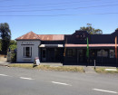
NATIONAL SCHOOL NO.741
 Victorian Heritage Inventory
 -
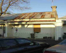
CAPE HOUSE
 Glenelg Shire
 -
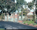
CAPE BRIDGEWATER HOMESTEAD
Glenelg Shire
-
-