Back to search results
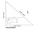
MACCLESFORD REEF MINE
28 HADDON-WINDERMERE ROAD HADDON, GOLDEN PLAINS SHIRE
MACCLESFORD REEF MINE
28 HADDON-WINDERMERE ROAD HADDON, GOLDEN PLAINS SHIRE
All information on this page is maintained by Heritage Victoria.
Click below for their website and contact details.
Victorian Heritage Inventory
On this page:
Statement of Significance
What is significant?
How is it significant?
Why is it significant?
Show more
Show less
-
-
-
-
STANDARD GULLY SHALLOW ALLUVIAL SINKINGS ON NORTH SIDE
 Victorian Heritage Inventory
 -
NORTH ARM OF STANDARD GULLY ALLUVIAL SINKINGS MIDWAY BETWEEN THIS AND NUGGETTY GULLY
Victorian Heritage Inventory
-
NUGGETTY GULLY ALLUVIAL SINKINGS (1)
Victorian Heritage Inventory
-
-