CROWS NEST FORT
14 THE ESPLANADE QUEENSCLIFF, QUEENSCLIFFE BOROUGH
-
Add to tour
You must log in to do that.
-
Share
-
Shortlist place
You must log in to do that.
- Download report
Statement of Significance
Part of the 1880s defence networks for Queenscliff and Port Phillip. Significant single gun (HP) fortress. Probably partially intact below the current sand topsoil. Possible State Level Significance as a component of the 1880s defence landscape of Port Phillip. Recreational bathing boxes part of the recreational landscape of the military.
-
-
CROWS NEST FORT - History
In 1886, a eight inch disappearing gun was placed at Crows Nest, much to the disgust of local residents as the location was a popular hill (of that same name) and they feared the loss of much loved local vegetation.The gun appears to have been active by 1891, as firing times and exclusion zones were announced in local newspapers. Tenders were called for a gun eplacment and 6lb Nordenfelt Gun at the fort in 1892, although it is unclear if these ever eventuated.
The fort is shown in defence plans (Barrett, 1916) as an obsoletesingle gun emplacment with a sloping external casement wall on the seaward end,with a depressed area to the north that housed the gun. From 1925- 1929, a one gun fort was located down near the Officers Mess (Maytone), but that it was never fired during this time. A disappearing gun was mounted at Crows Nest, but was removed around the time of WWII as scrap metal was at a premium at that time, which resulted in many of the earlier guns being removed from the forts around the heads.A breech loading gun currently outsideFort Queenscliff is labelled as having originated from the Crows Nest Fort.
In 1908, an Engine room and gun emplacements were built at Crows Nest (unclear if the camp or Fort)
The fort was used during WWI, and was used as an informal camp site by swagmen for many years after it was abandoned.
The back beach was closed off from 1942 until the end of the war. There was barbed wire from the cliffs all the way around to Cottage by the Sea.
There was an emplacement at Lonsdale Bight behind Camp Wyuna. You go in at Fraser St to the end and park there. There us a walkway between the houses and turn right at the top. There was more stuff there before, and it is possible that it also had a roof. Crows nest fort is at the end of Henry St near Santa Casa. The hollow is the gun emplacement, and the rise is the concrete bunker around it. There were rails and a base in the area too at one time, until the army blew it up in the 1950s. There is a very good chance that the pillbox was built in conjunction with Crows Nest Fort as an observation post. If you look at the point below where the opening is there is the remains or marking of abrass plate or table, and this may have been used to sight a vessel coming through the heads and take a distance reading to telegraph to the fort. If Crows nest fort also took bearings they could work out the distance to the ship for firing. (Patrick, pers comms)
Some locals reported that the Crows Nest Fort was demolished by the army with explosives in the 1960s.
Additionally, other facilities, such as the Cottage by the Sea children’s home was taken over by the army to house soldiers during the WWI which deprived sick children of their annual seaside holidays. Ladies and Gents Bathing boxes are shown at the site in 1916 & 1918 (Barrett , Read).
John Patrick, a former local resident and member of the Queenscliff Historical Societyhas undertaken personal research for the sites:
"I remember it quite well. Crow's Nest Fort had a circular paved area for the gun, protected on the seaward side by a vertical concrete wall about 2.5 metres high. Beyond that protecting wall sand and concrete had been sited so the fort merged into the hill and was not easily detected from the sea. There was a circular rail inset into the circular paved area, presumably to enable the gun to be rotated. The original gun had been removed long before my first seeing the fort. There was at least one door opening in the west end of the concrete wall with steps leading down underground to what I presumed to be a place for storing ammunition.
At the same level as the circular paved area was a further flat paved area, to the north reaching to a high wooden fence that ran along the northern boundary of the land and extended around part of the eastern boundary.
Beyond that fence to the north was a wide piece of unoccupied land and the remaining land to Flinders Street was occupied by Upton House, a convalescent home for aged people and to the east of that The Cottage by the Sea operated by the Ministering Children's League.
At some later stage the enclosed circular paved area had been covered by a flat galvanised roof and large doors had been fitted on the north side to enclose that area. It was used for military purposes during the 1939-45 war.
I believe those doors may have survived and are still in use in Queenscliff.
The paved areas, concrete structures and earth works of the fort were still as originally constructed in August 1948 when the Queenscliff Sewerage Authority survey drawings were prepared and a copy of part of that plan is shown above.
As further confirmation of its existence, the site is recorded as land set aside for the use of the Commonwealth of Australia down to the high-water line on the Parish Plan as Crown Allotment 6, Section 31, Township of Queenscliff, County of Grant, Parish of Paywit."
CROWS NEST FORT - Interpretation of Site
1880s single hydropneumatic gun (disappearing gun) fortress. The curved concrete sections at the southern end of the site are probably remnants of the facing wall of the casement. The depression behind these walls is consistent with the plans showing a excavated casement area. Other concrete sections at the eatern and western extremities of the site are the edges of the casement area. The site is probably substantially buried under sand a topsoil, and althoughreport of blasting of the site were reported by local community members, it is probably that landfill has been dozed over the site.
Heritage Inventory Description
CROWS NEST FORT - Heritage Inventory Description
Large curved sections of concrete at ground level at the southern section of the site exposed for up to 10 metres in length. Substantial square sections of concrete and brick debris scattered around site
Structural concrete fortifications, including the internal and external casement walls.Probable buried structural remains and archaeological debris associated withsite use. Scattered 19th century artefacts on surface. Possible remainsof bathing boxes and associated artefacts.
Archeological Potential: Excellent
-
-
-
-
-
LATHAMSTOWEVictorian Heritage Register H1052
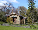
-
PILOTS COTTAGESVictorian Heritage Register H1618
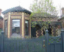
-
ROSENFELDVictorian Heritage Register H1134
-
-