Back to search results
MCGREGOR STREET UNIDENTIFIED STONE STRUCTURE
255 BEACONSFIELD PARADE MIDDLE PARK, PORT PHILLIP CITY
MCGREGOR STREET UNIDENTIFIED STONE STRUCTURE
255 BEACONSFIELD PARADE MIDDLE PARK, PORT PHILLIP CITY
All information on this page is maintained by Heritage Victoria.
Click below for their website and contact details.
Victorian Heritage Inventory

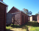
McGregor St Unidentified Stone Structure Port Melbourne March 2003 McGregor St Drain 001


On this page:
Statement of Significance
This record has minimal details. Please look to the right-hand-side bar for any further details about this record.
Show more
Show less
-
-
-
-
PRIMARY SCHOOL NO.2815
 Victorian Heritage Register H1711
 -
MIDDLE PARK CHINESE FISHERMEN'S HUTS
 Victorian Heritage Inventory
 -
ST KILDA PIER
Victorian Heritage Inventory
-
-