Back to search results
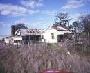
WOAH HAWP CANTON MINE SETTLING PONDS
705-711 GEELONG ROAD CANADIAN, BALLARAT CITY
WOAH HAWP CANTON MINE SETTLING PONDS
705-711 GEELONG ROAD CANADIAN, BALLARAT CITY
All information on this page is maintained by Heritage Victoria.
Click below for their website and contact details.
Victorian Heritage Inventory
On this page:
Statement of Significance
The Woah Hawp Canton Mine Settling Ponds is of local significance due to its association with the Gold Rush generally, and Chinese miners in Ballarat more specifically.Under the terms of the Heritage Act 2017 there is protection for all historical archaeology sites and objects in the state.
Please visit the Heritage Victoria website to find out more about the Heritage Inventory.
Show more
Show less
-
-
-
-
BALLARAT MUNICIPAL OBSERVATORY
 Victorian Heritage Register H0936
 -
PORTER PREFABRICATED IRON STORE ORIGINALLY IN GEELONG
Victorian Heritage Register H2248
-
MINERS RIGHTS COLLECTION
Victorian Heritage Register H2112
-
-