Back to search results
FORMER KARDELLA RAILWAY STATION AND SETTLEMENT
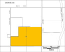
KARDELLA ROAD, KARDELLA VIC 3951
FORMER KARDELLA RAILWAY STATION AND SETTLEMENT
KARDELLA ROAD, KARDELLA VIC 3951
All information on this page is maintained by Heritage Victoria.
Click below for their website and contact details.
Victorian Heritage Inventory
On this page:
Statement of Significance
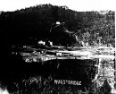
This site is associated with the Great Southern Railway which linked Melbourne in the west with Port Albert in the east. Kardella station was constructed as part of the section of railway between Whitelaw’s Track (Korumburra) and Toora which was opened on 17 June 1891.
The former Kardella railway station site has archaeological potential which could provide further information relating to Linking Victorians by Rail (Historical Theme 3.3).
Show more
Show less
-
-
-
-
NORTH MELBOURNE POTTERY
 Victorian Heritage Inventory
 -
STONY CREEK SLIPWAY
Victorian Heritage Inventory
-
SEASONING WORKS SITE AND TERRACOTTA LUMBERWALL
Victorian Heritage Inventory
-
-