Back to search results
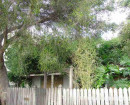
FORMER RICE'S FARM
BAYVIEW ROAD, OFFICER VIC 3809 - Property No 66
FORMER RICE'S FARM
BAYVIEW ROAD, OFFICER VIC 3809 - Property No 66
All information on this page is maintained by Heritage Victoria.
Click below for their website and contact details.
Victorian Heritage Inventory
On this page:
Statement of Significance
What is significant?
The proposed Former Rice’s Farm site is within an open paddock. Archaeological features comprise three raised earthen platforms with concrete like and stone footings, and a brick cistern. The ‘concrete’ is possibly Portland cement, commonly used in the late nineteenth century.
The cistern/well is made of ‘Northcote’ bricks and damaged at the top. The structure is comparable with the Dalmore Homestead well (dated to c.1883) identified on the Pakenham Planning Scheme. There is a large refuse pile in proximity to the well, that included ‘Northcote’ bricks. The pile is likely to be a demolition deposit from a larger structure.
Other identified artefacts include discarded farm machinery with the patent stamp ‘Richmond and Chandler Manchester’ which likely a chaff cutter that dates to the 1860s.
Other identified artefacts include discarded farm machinery with the patent stamp ‘Richmond and Chandler Manchester’ which likely a chaff cutter that dates to the 1860s.
A detailed historical background was not provided with the site card the card however, the land is a part of the original Mt Pleasant pastoral station, and in 1866 the land was sold as town allotment. Mark Rice purchased a number of these allotments and who identified as a farmer who sold cattle and horses. He died in 1873 and the property passed to his daughter, Eliza.
Officer became a post-war solider settlement. Aerial photographs 1968 shows structures in the southwest corner of the study area and a later 1975 aerial photograph shows that these structures were demolished.
How is it significant?
The site is of local historical and archaeological significance.
Why is it significant?
The site is of local historical significance as a rare example of nineteenth century farm occupation in the area, the site has the archaeological potential to reveal information about the late nineteenth century farming activities and possible residential occupation, in addition to revealing information about post-war solider settlement patterns and occupation.
Show more
Show less
-
-
-
-
NORTH MELBOURNE POTTERY
 Victorian Heritage Inventory
 -
STONY CREEK SLIPWAY
Victorian Heritage Inventory
-
SEASONING WORKS SITE AND TERRACOTTA LUMBERWALL
Victorian Heritage Inventory
-
-