Back to search results
OTTERBURN FARM COMPLEX
545 TRAMWAY ROAD HAZELWOOD NORTH, LATROBE CITY
OTTERBURN FARM COMPLEX
545 TRAMWAY ROAD HAZELWOOD NORTH, LATROBE CITY
All information on this page is maintained by Heritage Victoria.
Click below for their website and contact details.
Victorian Heritage Inventory
On this page:
Statement of Significance
What is significant?
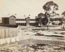
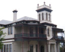
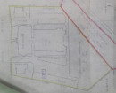
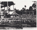
The Otterburn Farm Complex comprises the remains of three historically significant buildings associated with late 19th and early to mid-20th century residential, farming and dairying activity. The site comprises the location of two residences and a farm building which are first depicted in a 1935 aerial photograph, with the residences likely corresponding with two houses built by Donald Shaw in the 1870s and 1880s. A domed cistern remains at the location of the former residential buildings, while concrete building foundations exist at and immediately to the south of the 1935 farm building.
How is it significant?
The Otterburn Farm Complex is of local historical and archaeological significance.
Why is it significant?
The Otterburn Farm Complex is of historical significance for its association with Donald Shaw, the first President of the Morwell Shire Council and a notable public figure associated with the development of Morwell. Otterburn represents one of the earliest farming estates in Hazelwood, having been purchased by Donald Shaw in 1872 and continuing to be operated by his wife Lily Shaw after his death in 1911. This site is further notable for its continuous use as a dairy farm for over 150 years, having served this function from 1872 through to the present day.
The site is of archaeological significance due to the moderate likelihood of archaeological deposits remaining at the site. Archaeological deposits and features are moderately likely to exist in a subsurface context at the location of the two homestead buildings, as well as around the edges of the concrete foundations of the 1935 farm building. There is also a high potential for archaeological deposits to exist at the base of the cistern, beneath more recent accumulations of refuse. Any archaeological deposits or features are anticipated to shed light on farming activities undertaken by the Shaw family in the late 19th to early 20th century, as well as assist in more conclusively determining the age of the residences and farm building. Additionally, archaeological deposits associated with the residence are likely to shed light on everyday farming life in late 19th to mid-20th century Hazelwood North.
Show more
Show less
-
-
-
-
-
NORTH MELBOURNE POTTERY
 Victorian Heritage Inventory
 -
STONY CREEK SLIPWAY
Victorian Heritage Inventory
-
SEASONING WORKS SITE AND TERRACOTTA LUMBERWALL
Victorian Heritage Inventory
-
-