Back to search results
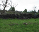
HALLETTS LANE WATER CONDUIT
152 YANDOIT CREEK ROAD YANDOIT, HEPBURN SHIRE
HALLETTS LANE WATER CONDUIT
152 YANDOIT CREEK ROAD YANDOIT, HEPBURN SHIRE
All information on this page is maintained by Heritage Victoria.
Click below for their website and contact details.
Victorian Heritage Inventory
On this page:
Statement of Significance
This record has minimal details. Please look to the right-hand-side bar for any further details about this record.
Show more
Show less
-
-
-
-
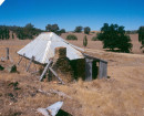
BBP 15 PUDDLER, HALLETS LANE, YANDOIT
 Victorian Heritage Inventory
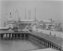
 -
MINING COMPLEX, YANDOIT CREEK
Victorian Heritage Inventory
-
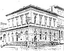
BBP 18 COLLAPSED STONE STRUCTURE, YANDOIT
Victorian Heritage Inventory
-
-