Puddlers, Dams and Water Race, Rostrons, STUART MILL
STUART MILL, NORTHERN GRAMPIANS SHIRE
-
Add to tour
You must log in to do that.
-
Share
-
Shortlist place
You must log in to do that.
- Download report
Statement of Significance
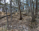
Features of this site include a large partly silted dam, a very weathered puddler, 75 m long water race to another large breached dam, and a band of shallow alluvial sinkings. The features are in reasonable condition and are therefore able to demonstrate puddling technology and aspects of shallow alluvial mining, enhanced by the survival of the unusual water race linking the two puddling dams.
The Puddlers, Dams and Water Race, Rostrons are historically and scientifically important at a LOCAL level as a substantially intact example of an important gold mining technique. Gold Mining sites are of crucial importance for the pivotal role they have played since 1851 in the development of Victoria.
Overall the Puddlers, Dams and Water Race, Rostrons are of LOCAL significance.
RECOMMENDED LEVEL OF SIGNIFICANCE: LOCAL
-
-
Puddlers, Dams and Water Race, Rostrons, STUART MILL - Physical Description 1
DESCRIPTION & INTERPRETATION:
Site 66.0.
Puddler No 1. (Survival of slabbing suggests late 1890s/20th century date). Puddler. On the western end of the dam's embankment is a well preserved 22 ft diameter puddling machine site. The puddling trench is deep, has sheer sides. Scattered around the puddler sections of the side slabbing. Presumably these have been pulled out by fossickers looking for gold. The pivot post has also been removed from the inner mound. The outlet channel still retains a well preserved timber shoot. Associated with the puddler is a 10 metre wide, 2 metre high bank of wash.
Shallow alluvial sinkings. The sinkings in the gully below the puddler, running to the Rostrons Road, are undisturbed and visible from Centre Road. There is a working alluvial claim in the gully above the puddler/dam.
Puddlers, Dams and Water Race, Rostrons, STUART MILL - Physical Description 2
DESCRIPTION & INTERPRETATION:
Site 66.1.
Puddler No 2. (Middle Creek). Weathered state of the puddler suggests it last operated during the nineteenth century.
Puddler. Weathered 20 ft diameter puddling machine site: the inner mound has eroded badly, nearly filling the puddling trench. The weathering has exposed a the pivot post. The puddler has an unusual feature in that its builder(s) used a hollow log for the outlet channel.
Puddlers, Dams and Water Race, Rostrons, STUART MILL - Physical Description 3
DESCRIPTION & INTERPRETATION:
Site 66.2.
Puddler No 3. (Weathered state of the puddler suggests it last operated during the nineteenth century).
Puddler. Located at the head of the gully is a large, partly silted, dam. On the north end of the dam's embankment is a very weathered puddler. The inner mound has eroded away filling the puddling trench. The puddler now is no more than a circular depression. Lots of wash associated with the puddler.
Water race. A 75 metre long water race runs north from the dam. This race runs to a large breached dam in the next gully (Site 66.3).
Alluvial sinkings. A band of well defined shallow sinkings runs along the north side of Rostron-Stuart Mill road, between Centre and Boundary Roads.
Puddlers, Dams and Water Race, Rostrons, STUART MILL - Physical Description 4
DESCRIPTION & INTERPRETATION:
Site 66.4. Puddler No 5 (Weathered state of the puddler suggests it last operated during the nineteenth century).
Puddler and dam. A small silted dam is located at the head of a gully, near the eastern side of Boundary Road. The puddler has a diameter of 18 ft, and has been badly eroded by water coming from a breach in the dam. The inner mound is still visible, but not pivot post is present. Alluvial sinkings. A band of undisturbed shallow sinkings runs down the gully and peters out once meeting with the main channel.
Puddlers, Dams and Water Race, Rostrons, STUART MILL - Physical Description 5
INTEGRITY/CONDITION: All sites are in reasonable condition, except for Site 66.4.
CULTURAL SIGNIFICANCE:
Site 66.4 has poor integrity and hence low cultural significance.
Sites 66.0, 66.1, 66.2 and 66.3 have:
. Scientific Significance, due to their ability to demonstrate puddling technology and shallow alluvial mining. The significance of Site 66.1 and Sites 66.2/66.3 are enhanced by the fact that they have some unusual features, the former, has a hollow log for an outlet channel, and the latter sites, have a water race which connects the two puddling dams.
Heritage Study and Grading
Northern Grampians - Shire of Northern Grampians - Stage 2 Heritage Study
Author: Wendy Jacobs, Vicki Johnson, David Rowe, Phil Taylor
Year: 2004
Grading: Local
-
-
-
-
-
GISIS CO MINE SITE, STUART MILLVictorian Heritage Inventory
-
MINE WORKINGS STUART MILLVictorian Heritage Inventory
-
Malcom's Corner General StoreNational Trust
-
-