Queenscliff Cemetery
Williams Road and Point Lonsdale Road and Grant Road and Jordon Road QUEENSCLIFF, QUEENSCLIFFE BOROUGH
-
Add to tour
You must log in to do that.
-
Share
-
Shortlist place
You must log in to do that.
- Download report
Statement of Significance
Statement of Significance as recorded under the Queenscliff Heritage Study 2009
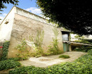
In housing Queenscliff's dead, the Cemetery demonstrates, at a typical but long-standing municipal level, the constituent groups in its community, the position of specific families, the diversities of ethnic backgrounds, changing mortality patterns and causes, and changes in cemetery design and culture. The pavilion at the northeast corner is also of long-standing by standards of such municipal cemeteries, being constructed, by appearance, between c. 1900 and 1919.[i] In addition, the area is one of great natural beauty, and one of the last open and relatively undeveloped areas of the Point, with broad views across to Queenscliff.
[i] In comparison with Box Hill's for example, which dates from the 1920s.
-
-
Queenscliff Cemetery - Usage/Former Usage
Extract from the 1982 study
The cemetery reserve at Point Lonsdale was gazetted in 1856. Prior to this a burial area existed at the end of the continuation of Learmonth Street southwards through the Public Recreation Reserve. In 1857, the reserve is described as being thickly wooded with Gums and Acacia, and later as being well grossed and dotted with Sheoaks. The first burials were carried out in the cemetery in 1856, although the first officially recorded burials did not occur until 1864 when the Borough Council was created.
Queenscliff cemetery contains the remains of many of the prominent citizens in the town as well as a number of people of regional and state importance.
In addition the area is one of great natural beauty and one of the lost open and relatively undeveloped areas of the Point, with brood views across to Queenscliff township.Queenscliff Cemetery - Physical Description 1
Landscape/Streetscape
The landscape and streetscapes in this area should be subject to further detailed study and a program established for preservation of existing planting and for future planting. Where possible the indigenous planting in the area that existed in the I850s should be reinforced and early species reintroduced. The areas of ornamental planting should be preserved within such an approach. Future clearing should be limited to only that required to make way for graves and areas of vegetation should be maintained within the graves areas. The gravel pathways and tracks within the cemetery area should be maintained without the introduction of kerb and channelling or hard paved surfaces. The existing area of precast concrete kerbing to the northern entry drive should preferably be replaced with a stone pitcher spoon drain.
Queenscliff Cemetery - Physical Description 2
Extract from the 2009 study
There are two entries to Point Lonsdale Road: an east gateway partway along the Point Lonsdale Road boundary[i] and the other, the Baillieu Memorial Gates in wrought iron with basalt ashlar stone piers (1953) at the corner of Point Lonsdale Road and Jordon Street. Other entries are from Jordan Street, c.150m further west, and from Williams Road. There is a charnel house near the Cemetery's north-east corner, probably dating from the 1890s or 1900s,[ii] with tuckpointed red-brick walls and a hipped mansarded roof clad in corrugated galvanised steel with rebuilt arcroterion mouldings at its upper level, a perimeter verandah, recent verandah posts, and a concreted verandah floor. The small octagonal gazebo at the centre of the site is a recent addition.
The graves and headstones, beginning in the 1850s, cover a roughly L-shaped area at the south-east of the site, apart from a small Jewish section near the site centre. Two more recent areas, mostly the 1980s and 1990s onward, are along the Jordan Street side of the site to the northeast, extending from the Baillieu Gates driveway toward Grant Street to the northwest. The two main driveways, both on the north side and from Jordan Street, are sealed. The new memorial areas are uniformly of inlaid panel markers in rows, clearly visible in aerial photographs, and these appear designed to accommodate either graves or cremation urns. To the west end of the site the area is either open field, as in the north-west portion toward Grant Street, or a rectangular stretch of natural scrub and bushland, along the Williams Road side down to the Grant Street corner.
Tomb monuments are the conventional spectrum, from white marble headstones and crosses in the nineteenth century running through rounded panel granite 'bed' types common between the 1920s and 1970 (see illustration), with some photograph-tombs and several sculpted and polished irregular stone rubble tombs, particularly near the centre of the site, and particularly for those who have died young. Early military personnel are commemorated in a 'VR' obelisk at the Williams Road side, with names commencing in the 1860s and continuing through to the 1880s. Two late-1850s sandstone headstones are located near-by. The condition of the tombs is reasonable given weathering and sun exposure and there appears to be little subsidence or vandalism. On the Monday it was surveyed there were about 20 people visiting various parts of the site over a period of one hour.
[i] Illustrated in Allom Lovell, 1984, p. 267.
[ii] Allom Lovell, 1984, p. 265.
Heritage Study and Grading
Queenscliffe - Queenscliffe Urban Conservation Study
Author: Allom Lovell & Associates P/L, Architects
Year: 1982
Grading:Queenscliffe - Queenscliffe Heritage Study
Author: Lovell Chen
Year: 2009
Grading:
-
-
-
-
-
85 Bellarine Highway, Point LonsdaleQueenscliffe Borough
-
Point Lonsdale Road FortificationsVic. War Heritage Inventory
-
Queenscliff Powder StoreVic. War Heritage Inventory
-
-