Back to search results
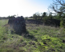
GAMBETTA MINE SITE
410 DRY GULLY ROAD OMEO, EAST GIPPSLAND SHIRE
GAMBETTA MINE SITE
410 DRY GULLY ROAD OMEO, EAST GIPPSLAND SHIRE
All information on this page is maintained by Heritage Victoria.
Click below for their website and contact details.
Victorian Heritage Inventory
On this page:
Statement of Significance
Show more
Show less
-
-
-
-
NORTH MELBOURNE POTTERY
 Victorian Heritage Inventory
 -
STONY CREEK SLIPWAY
Victorian Heritage Inventory
-
SEASONING WORKS SITE AND TERRACOTTA LUMBERWALL
Victorian Heritage Inventory
-
-