WESLEYAN CHURCH RESERVE (FORMER)
10A HYDE STREET, FOOTSCRAY VIC 3011
-
Add to tour
You must log in to do that.
-
Share
-
Shortlist place
You must log in to do that.
- Download report
Statement of Significance
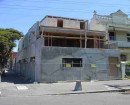
-
-
WESLEYAN CHURCH RESERVE (FORMER) - History
Wesleyan Church Reserve (1869-1895) In 1869, the Wesleyan Church commenced construction of a bluestone church on an acre of land fronting Hyde Street – this land was permanently reserved for church purposes in 1870 (Williamstown Chronicle, 25 Dec. 1869, p. 4; VGG, 25 Mar. 1870, p. 378). Prior to the establishment of the Hyde Street Church, the Wesleyan congregation reportedly held services in a timber church at the eastern end of Napier Street. In 1869 the Napier Street ‘church’ was relocated to Hyde street and erected at the rear of the new bluestone church where it served as a Sunday school. The bluestone church and timber ‘Sunday school’ were located in the northern portion of the reserve (Barnard et al., 2000 Vol 2, 46-52; Butler 1989, pp. 81-83). By 1882, the Wesleyan church had established a ‘parsonage’ at Footscray (The Leader, 02 Dec. 1882, p. 40; The Argus¸ 28 Jul. 1883, p. 1). Although the exact location of this dwelling is uncertain, it is possible that it was a purpose-built structure located within the Hyde Street church reserve. Modifications were made to the Hyde Street church in 1888, including interior alterations and a western extension to the footprint of the building. The timber Sunday school – former church building - was relocated to the southeast corner of the church reserve in the same year. The construction of a ‘new’ two-storey brick parsonage to the rear of the church was completed by February 1888 – located within the reserve, northwest (Argus, 03 Dec. 1953, p. 26; Butler, 1989, pp. 81-83; Independent, 21 May 1887, p. 2 & 04 Feb. 1888, p. 3). An 1895 Melbourne Metropolitan Broad of Works (MMBW) plan depicts extant structures and services within the reserve: • Within the reserve – timber Sunday school/relocated former church and paved entrance (E), church/Sunday school grounds (W), cesspit or water closet (SW); school grounds (S); fencing (S); church (north), domestic dwelling /parsonage (northwest, facing railway parade). • In the vicinity of the reserve - school and school grounds (S). Wesleyan Church Reserve (1895-1953) Services continued to be held in the Church and the ‘Sunday school’ continued to function as a denominational school until the mid-twentieth century (Argus, 03, Dec. 1953, p. 26; Butler, 1989, pp. 81-83). In an aerial photograph of the reserve dating c.1920-1940, all structures marked on the 1895 MMBW plan are evident, including: bluestone church (northeast), two-storey brick ‘parsonage’ and associated fencing (northwest), and the timber ‘Sunday school’ (southeast). In addition, two structures are evident that post-date 1895, including: a single storey structure – possible dwelling (southwest); and an addition (or possible separate building) to the rear of the timber ‘Sunday school’. It is likely that the structure to the rear of the timber ‘Sunday School’ was used for church/school activities during the early nineteenth century. A review of accessible historic records has not identified the function and exact construction date of the single storey structure evident in the southwest corner of the reserve. Given that the land remained property of the Wesleyan congregation during this period, it was presumably constructed by the church. The structure’s architectural form is suggestive of a dwelling predating c.1920; however, it should be noted that the resolution of the image prevents any firm conclusions being drawn regarding architectural style. An aerial image dating to 1945, suggests that no significant landform modification occurred within the majority of the study c.1920-1945, the major structures evident in the c.1920 –1940 image remaining on the land until at least 1945. The exception is the northern limit of the reserve where trees have been cleared and a laneway – now Lawson Place - has been constructed. It should be noted that the low resolution of this image precludes the secure identification of any specific features within the reserve. In 1953 the timber Sunday school was partially destroyed in a fire, and the damaged structure was demolished and removed (Argus, 03, Dec. 1953, p. 26). Wesleyan Church Reserve (former) (1953-2020) A 1979 aerial images of the reserve, shows the location of a number of new buildings constructed within the former ‘Wesleyan Church Reserve (former)’ between 1953 and 1979, including: • A large timber building approximating - the footprint of the former Sunday school – the structure now used as a community hall; • A smaller timber to building to the west of the hall – the ‘Hyde Street kindergarten’; • Two rectangular structures to the rear of the church – one possible a demountable or storage container, and an amenities block; and • A brick garage in the southeast. • The resolution of the 1979 image is relatively poor; however, it appears that the former ‘parsonage’ and the 1895-c.1920 structure (possible dwelling) in the western half of the reserve (former) - were still standing at this time. A review of aerial images indicate that a number of changes were made to the reserve (former) post 1979, including: minor landscaping (east and north), and construction of an asphalted car park (west). Based on this image review, it was not possible to determine the sub-surface impact of these more recent modifications.WESLEYAN CHURCH RESERVE (FORMER) - Interpretation of Site
N.B. Additional details including the results of the site inspection (Section 4) and Assessment of Archaeological Potential (Section 5); are in included in the ‘Archaeological Assessment Report’ (Heritage Insight P/L, 2020) submitted as supporting documentation with this site card. Analysis of site (interpretation) As a result of the archaeological assessment (report provided as supporting documentation; Heritage Insight P/L 2020) the nominated site has been assessed as having more than a ‘low level of archaeological significance’; as detailed below: Threshold A (archaeology) Background research and the site inspection indicate that: • There is ‘moderate potential’ for archaeological features and deposits to be preserved within part of the study area; and • Any preserved archaeological features and/or deposits will be associated with the nineteenth to early twentieth century occupation of the site for ‘church purposes’, and are likely to be in a condition that could contribute to an understanding of the sites historic occupation. All portions of the study area - former ‘Wesleyan Church Reserve’ (former) - assessed as having more than ‘low archaeological potential’ have been recommended for inclusion in the Heritage Inventory; as illustrated in Attachments 2-3. • The southeast portion of the ‘Wesleyan Church Reserve’ (former) has been subject to significant ground disturbance/landform modification (dating c.1953-2020), which has likely resulted in the destruction/removal of any significant archaeological features or deposits. Any archaeological feature or deposits preserved here are unlikely to contribute to the known history of the site. This portion of the ‘Wesleyan Church Reserve’ (former) has not been recommended for inclusion in the Heritage Inventory. • The extant bluestone church has been identified as a significant historic structure - originally constructed in 1869 and modified in 1888. However, given that background research indicates that the existing church is the first structure built on the site, it is considered unlikely that archaeological features or deposits predating the church’s construction are preserved within its footprint. This portion of the former ‘Wesleyan Church Reserve’ is not recommended for inclusion in the Heritage Inventory (Attachment 2-3). • Land immediately surrounding the extant church does not appear to have been subject to significant ground disturbance/landform modification (dating c.1953-2020); however, given that historically this area was an exterior space, and part of the non-residential portion of the site, it is unlikely that significant archaeological features or deposits are preserved here. This portion of the former ‘Wesleyan Church Reserve’ has been identified as having negligible archaeological potential. The extant church and immediate adjacent land have not been recommended for inclusion in the Heritage Inventory; however, it should be noted that this area is currently listed on the Heritage Overlay (HO46) (Attachments 2-3) Threshold B (place history) Background research indicates that: • The site is clearly associated with the nineteenth century establishment of the Wesleyan church at Footscray; • It is the site of the Wesleyan Footscray congregation’s first purpose-built church and ‘Sunday school’; and functioned as a centre of worship, denominational education, and community life from 1869 to c.1953; and • Part of the site was occupied for residential purposes (parsonage) from at least 1888. All portions of the ‘Wesleyan Church Reserve’ (former) - assessed as having more than ‘low archaeological potential’ have been recommended for inclusion in the Heritage Inventory (Attachments 2-3).
Heritage Inventory Description
WESLEYAN CHURCH RESERVE (FORMER) - Heritage Inventory Description
The site currently encompasses a large timber hall (southeast); brick garage and associated concrete driveway (southeast); a timber kindergarten, associated amenities block and landscaped grounds (central); a bluestone church (northeast); pathways and asphalt paving (east and central); grassed areas (east); an asphalt paved laneway (north); an outdoor carpark (west); and mature trees (central and west) (See Attachments 3 and 4; and supporting documentation; ‘Archaeological Assessment’ Map 2; Plates 1-37).
-
-
-
-
-
NORTH MELBOURNE POTTERYVictorian Heritage Inventory
-
STONY CREEK SLIPWAYVictorian Heritage Inventory
-
SEASONING WORKS SITE AND TERRACOTTA LUMBERWALLVictorian Heritage Inventory
-
-