Back to search results
GRASSES TRACK ARTEFACT SCATTER
GRASSES TRACK AND RIVER TRACK, BENWELL FOREST, MYALL
GRASSES TRACK ARTEFACT SCATTER
GRASSES TRACK AND RIVER TRACK, BENWELL FOREST, MYALL
All information on this page is maintained by Heritage Victoria.
Click below for their website and contact details.
Victorian Heritage Inventory
On this page:
Statement of Significance
What is significant?
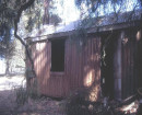
The Grasses Track Artefact Scatter is an archaeological site located immediately east of Grasses Track within Benwell Forest, Myall. The site extends across an area of approximately 15 m diameter and consists of an excavated depression containing potentially desugared refuse from the late 19th to the mid-20th century.
How is it significant?
Grasses Track Artefact Scatter is of local archaeological significance.
Why is it significant?
Archaeological excavation may identify further articles whose diagnostic features may provide information on consumerism, trade and aspects of forestry practices and life in the region. The excavated depression and presence of modern refuse amongst late nineteenth to mid-twentieth century items suggest the site has been utilised over a long period of time and likely constitutes a secondary dumping location created by either local forestry workers or members of the local farming community. Archaeological excavation may identify further articles whose diagnostic features may provide information on consumerism, trade and aspects of forestry practices and life in the region.
Show more
Show less
-
-
-
-
NORTH MELBOURNE POTTERY
 Victorian Heritage Inventory
 -
STONY CREEK SLIPWAY
Victorian Heritage Inventory
-
SEASONING WORKS SITE AND TERRACOTTA LUMBERWALL
Victorian Heritage Inventory
-
-