Back to search results
FORMER SACHS BROTHERS COACH FACTORY
712-764 ELIZABETH STREET MELBOURNE, MELBOURNE CITY
FORMER SACHS BROTHERS COACH FACTORY
712-764 ELIZABETH STREET MELBOURNE, MELBOURNE CITY
All information on this page is maintained by Heritage Victoria.
Click below for their website and contact details.
Victorian Heritage Inventory
On this page:
Statement of Significance
What is significant?
The Former Sachs Brothers’ Coach Factory comprises the location of a former coach factory, which was established in 1859 and operated until 1947 under various phases of ownership. Historical documents, plans and aerial photographs indicate that the site encompassed several architectural components, including a main wheelwright’s workshop, forges, stables and a water closet.
How is it significant?
The Former Sachs Brothers’ Coach Factory is of local historical, scientific and archaeological significance.
Why is it significant?
The site is of historical significance due to it representing an early industrial site in the northern end of the settlement of Melbourne. The establishment of the Coach Factory in 1859 corresponds with the opening of the Melbourne Hay Market in the late 1850s, making it a prime example of the market-adjacent industries which came to characterise the inner northern suburbs of Melbourne in the mid to late 19th century.
The site is of scientific significance due to its potential to provide insight into industrial technological developments between the mid 19th and mid 20th centuries. As the site functioned as a Coach Factory/workshop for an 88-year period between 1859 and 1947, any architectural features or archaeological deposits are likely to shed light on changes in blacksmithing and wheelwright techniques and technology over this timeframe.
The site is of archaeological significance due to the likelihood of archaeological deposits remaining at the site. The probability of archaeological deposits ranges from ‘low’ to ‘high’ across the site (Figure 26), being lowest towards the deepest sections of the 1980s cut and ‘moderate’ in sections where the modern ground surface is level with the adjacent street level or where it follows the natural hillslope. The location of the water closet on the 1896 MMBW map has been marked as ‘high’, due to the potential of cesspit deposits being located in this area. Any archaeological deposits or features are anticipated to shed light on coachmaking activity undertaken onsite between the mid 19th century to mid 20th century, as well as potentially personal effects and recreational items associated with the workers employed at this site throughout this period.
Show more
Show less
-
-
-
-
-
VAULT
 Victorian Heritage Register H2450
 -
NORTH MELBOURNE POTTERY
 Victorian Heritage Inventory
 -
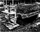
STONY CREEK SLIPWAY
Victorian Heritage Inventory
-
-