Back to search results
Sherbrooke Forest
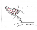
70A Monbulk Road, SHERBROOKE VIC 3789 - Property No 57571
Sherbrooke Forest
70A Monbulk Road, SHERBROOKE VIC 3789 - Property No 57571
All information on this page is maintained by Yarra Ranges Shire.
Click below for their website and contact details.
Yarra Ranges Shire

Sherbrooke Forest

On this page:
Statement of Significance
Sherbrooke Forest has State significance as a forest reserve since 1907, when it was known as Sherbrooke State Forest, becoming a park in 1958 and, from 1987, part of the Dandenong Ranges National Park. A major feature of Sherbrooke Forest is the remnant Mountain Ash trees, which are among the world's tallest flowering plants growing some 100 metres tall and living up to 500 years. Sherbrooke Forest has historical significance for its long history of use and appreciation by Melbourne people and as an important tourist destination. It has important historical associations with Ray Littlejohn and Ambrose Pratt, and there are memorials to both men within Sherbrooke Forest. Littlejohn was the first successful photographer of lyrebirds and made the first live radio broadcast of lyrebirds. Pratt, novelist, journalist and businessman, and author of The Lore of the Lyrebirds in 1933, was President of the Royal Zoological and Acclimatisation Society of Victoria between 1921 and 1936 and then Vice-Chairman of the Zoological Board of Victoria.
Show more
Show less
-
-
-
-
MAWARRA
 Victorian Heritage Register H2300
 -
Merrimu
 National Trust
 -
Former Marybrooke Guest House
National Trust
-
-