Back to search results
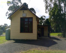
BARONGAROOK WATER TANK AND ASSOCIATED BOILER ASH HEAPS
OLD BEECHY RAIL TRAIL BARONGAROOK, COLAC OTWAY SHIRE
BARONGAROOK WATER TANK AND ASSOCIATED BOILER ASH HEAPS
OLD BEECHY RAIL TRAIL BARONGAROOK, COLAC OTWAY SHIRE
All information on this page is maintained by Heritage Victoria.
Click below for their website and contact details.
Victorian Heritage Inventory
On this page:
Statement of Significance
This record has minimal details. Please look to the right-hand-side bar for any further details about this record.
Show more
Show less
-
-
-
-
BARONGAROOK WATER TANK AND ASSOCIATED BOILER ASH HEAPS
 Victorian Heritage Inventory
-
-