THREE MILE CREEK SCATTER
20 GRAVEL PIT ROAD WANGARATTA SOUTH, WANGARATTA RURAL CITY
-
Add to tour
You must log in to do that.
-
Share
-
Shortlist place
You must log in to do that.
- Download report
Statement of Significance
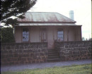
The site has potential archaeological deposits that may provide evidence of early squatting or land selection in the Wangaratta region.
-
-
THREE MILE CREEK SCATTER - History
The site is located on the extreme boundary of the two large pastoral Runs; Oven's Crossingand Laceby. Allotment 21 was surveyed in the 1860's and advertised for sale in 1864. The land came with 200 pounds of improvements. The land around Allotment 21 was quickly alienated, however Allotment 21 remained under a grazing licence until purchased by E. Worchester in the 1890's. A 1950's topographic map indicates a house where the site was identified.THREE MILE CREEK SCATTER - Interpretation of Site
Potentially a hut site from earliest period of occupation in the region i.e. pastoral run outstation, or a house site dating to c. 1860-1870. The lack of surface artefacts makes this difficult to interpret.
Heritage Inventory Description
THREE MILE CREEK SCATTER - Heritage Inventory Description
Minor scatter of highly fired, distorted bricks surrounded by very old peppercorn trees. Twelve large trees in total, with six trees grouped around brick scatter. Brick scatter extends 20 x 20 m.
Brick scatter, peppercorn trees. The number of visible bricks is less than 15, and most of these are broken in half.
Physical Conditions: Very poor, trees are fine.
-
-
-
-
-
THREE MILE CREEK SCATTERVictorian Heritage Inventory
-
-