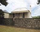
Red Bluff to Stockyard Point
JAM JERRUP VIC 3984 - Property No L10079
Statement of Significance
Red Bluff is the highest point of an eroding cliffed coast which slopes south to Stockyard or Passage Point, a cuspate foreland formed by a succession of curved sandy beach ridges enclosing swampy tracts between them.
The area was important in the pastoral era of settlement and stock from Red Bluff Station were shipped from the Point.
The eroding cliffs consist of Upper Tertiary ferruginous sandstones with mottled clay and a soil horizon above. Sand from the cliffs has covered the mudflats, which supported mangroves at the time of Smythe's survey of the coast in 1842. The chopping and burning of mangroves for ash ("barilla"), which was shipped to England for use in soap manufacture, was extensive in the 1840's and 1850's from this easily accessible area and probably accounts for the disappearance of mangroves.
From Red Bluff fine views of the thickly vegetated N.E. section of French Island and of the tidal passages of Western Port are obtained.
LOCATION:
On the eastern side of Western Port, south of the Lang Lang Beach, Public Purposes Reserve.
-
-
-
Red Bluff to Stockyard Point
 National Trust
-
-