Back to search results
Puckapunuyal Army Camp
Seymour Toorborac Road, PUCKAPUNYAL VIC 3662
Puckapunuyal Army Camp
Seymour Toorborac Road, PUCKAPUNYAL VIC 3662
All information on this page is maintained by Vic. War Heritage Inventory.
Click below for their website and contact details.
Vic. War Heritage Inventory
On this page:
Statement of Significance
National Estate
Statement of Significance : Puckapunyal Army Camp was first established by the Commonwealth government in 1939, in preparation for the Nation's contribution to World War II. Puckapunyal was the culmination of Victoria's main defence training facilities in the Seymour area. Puckapunyal is today Victoria's largest military training facility and is also one of Australia's most significant defence establishments. It played a vital role in preparing Australian troops for battle in three major international conflicts: World War II, the Korean War and the Vietnam War. It was also the accommodation and training venue for Victorian participants in the National Service scheme and the controversial Conscription ballots in the 1960s (Criterion A4. Historic Themes: 7.7.1 Providing for the common defence; 7.7.3 Going to war).
The Cantonment at Puckapunyal is significant for the grid system upon which its layout was developed. Although there have been considerable changes to the Cantonment and its grid system, as set out during the World War II period, the original axis and layout of domestic, administrative and parade ground facilities, is still highly evident (Criterion D.2).
Puckapunyal Army Camp is significant for its close association with generations of Australian troops and their families, most of whom have come from Victoria. It has been associated with members of Australia's standing army, as well as ready reserves, cadets, National Service personnel and, during the Vietnam War, those who were conscripted into the army via a nationwide ballot. It is also an important place for present-day survivors of the 17th Brigade, the first Victorian contingent to be sent on overseas service in World War II (Criterion G.1).
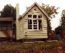
The surviving World War II buildings - the former Camp Headquarters and the 21 Construction Squad's compound - in addition to the original grid system of the Cantonment, are the last remaining physical reminders of Puckapunyal's contribution to the war effort in this period (Criterion B.2).
Statement of Significance : NATURAL VALUES
Puckapunyal contains a large and excellent example of Box-Ironbark Forest (Northern Goldfields) communities and good examples of Alluvial Terraces Herb-rich Woodland; Creekline Grassy Woodland communities; Buloke Woodland; White Box Woodland; Long-leaf Box Woodland; Native Grassland; and Wetland Herbfield all of which are restricted in Victoria.
At the time of European settlement, box-ironbark forest and woodland covered the inland slopes and plains from western Victoria to southern Queensland. Since then, 85 per cent of this ecosystem has been cleared in Victoria. Box-ironbark forests are poorly represented in reserve systems and have been substantially modified by forestry and mining activities.
The Range West and Graytown sections of Puckapunyal contain some of the largest remnants of box-ironbark forest in Victoria covering approximately 14,000 hectares. These areas of Puckapunyal provide a contiguous habitat with the Rushworth-Heathcote State Forest (incorporating Mount Black Flora Reserve/State Park, Whroo-Costerfield State Forest, Redcastle State Forest, Mt Ida Flora Reserve, Rushworth Forest Reference Area, proposed Whroo Nature Conservation Reserve) to the north and the Goulburn River Red Gum corridor, forming part of a crucial wildlife corridor comprising the largest remaining block of Box-Ironbark forest in Victoria.
Box-ironbark forest supports an assemblage of species from both Bassian and Eyrean biogeographical zones as well as many Box-ironbark 'stronghold species' which are not found in other habitat types, many of these species are threatened either nationally or in Victoria.
Puckapunyal Military Area contains the nationally vulnerable Trailing Hop-bush (DODONAEA PROCUMBENS) and Clover Glycine (GLYCINE LATROBEANA) and four species which are rare or threatened in Victoria: Buloke Mistletoe (AMYEMA LINOPHYLLA ssp. ORIENTALE), Swamp Diuris (DIURIS PALUSTRIS), Large Rustyhood (PTEROSTYLIS MAXIMA); and Western Golden-tip (GOODIA MEDICAGINEA). An additional 116 plant species are of regional significance
Puckapunyal is exceptionally diverse in native fauna for central Victoria, supporting 25 mammal, 182 bird, 11 frog and 7 native fish species.
The area contains the nationally endangered Swift Parrot (LATHAMUS DISCOLOR) and Regent Honeyeater (XANTHOMYZA PHRYGIA) which is critically endangered in Victoria an additional five bird species which are threatened in Victoria: Australasian Bittern (BOTAURUS POICILOPTILUS), Little Bittern (IXOBRYCHUS MINUTUS), Bush Stone-curlew (BURHINUS GRALLARIUS), Barking Owl (NINOX CONNIVENS), Powerful Owl (NINOX STRENUA).
The are contains the Squirrel Glider (PETAURUS NORFOLCENSIS) and the Tuan/Brush-tailed Phascogale (PHASCOGALE TAPOATAFA) which are threatened in Victoria. The area is a key location for the Common Dunnart (SMINTHOPSIS MURINA) and Fat-tailed Dunnart (SMINTHOPSIS CRASSICAUDATA) which are poorly known in Victoria.
Puckapunyal contains four freshwater fish species of rare or threatened in Victoria: the Golden Perch (MACQUARIA AMBIGUA), Freshwater Catfish (TANDANUS TANDANUS), the upper Wannon River Blackfish (GADOPSIS MARMORATUS) and the Mountain Galaxias (GALAXIAS OLIDUS).
In addition to the military facilities at Puckapunyal, there are several significant cultural features within its boundaries that pre-date the site's military function. In particular there are two former pastoral station homesteads, as well as archaeological remnants from the gold mining and forestry industries. The archaeological remains of the former Puckapunyal township, which existed in the late 19th Century, are also present, to the west of the present-day Cantonment.
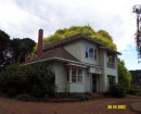
The Whitechurch Homestead was included in the Commonwealth's original 1939 land purchase. It comprises a 19th Century vernacular wattle and daub construction dwelling, with brick chimney and galvanised iron roof. The complex also comprises a pise kitchen building and several weatherboard sheds, and a shearing pavilion of drop-log construction.
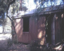
The Range Homestead was part of a portion of land purchased by the Commonwealth for Puckapunyal in 1966. The main house is constructed from stone with a mud mortar, with a relatively new corrugated iron roof. Outbuildings in this complex include a shearing shed, machinery shed, lavatory, underground water tank and well. The shearing shed is built with a tree trunk frame, and roofed with galvanised iron. The lavatory is rendered pise. The homestead is believed to date to the 1895-1905 period.
While not explicitly connected with Puckapunyal's military function, these homesteads and other remains provide important insight into the site's pre-Army history.
Statement of Significance : Puckapunyal Army Camp was first established by the Commonwealth government in 1939, in preparation for the Nation's contribution to World War II. Puckapunyal was the culmination of Victoria's main defence training facilities in the Seymour area. Puckapunyal is today Victoria's largest military training facility and is also one of Australia's most significant defence establishments. It played a vital role in preparing Australian troops for battle in three major international conflicts: World War II, the Korean War and the Vietnam War. It was also the accommodation and training venue for Victorian participants in the National Service scheme and the controversial Conscription ballots in the 1960s (Criterion A4. Historic Themes: 7.7.1 Providing for the common defence; 7.7.3 Going to war).
The Cantonment at Puckapunyal is significant for the grid system upon which its layout was developed. Although there have been considerable changes to the Cantonment and its grid system, as set out during the World War II period, the original axis and layout of domestic, administrative and parade ground facilities, is still highly evident (Criterion D.2).
Puckapunyal Army Camp is significant for its close association with generations of Australian troops and their families, most of whom have come from Victoria. It has been associated with members of Australia's standing army, as well as ready reserves, cadets, National Service personnel and, during the Vietnam War, those who were conscripted into the army via a nationwide ballot. It is also an important place for present-day survivors of the 17th Brigade, the first Victorian contingent to be sent on overseas service in World War II (Criterion G.1).
The surviving World War II buildings - the former Camp Headquarters and the 21 Construction Squad's compound - in addition to the original grid system of the Cantonment, are the last remaining physical reminders of Puckapunyal's contribution to the war effort in this period (Criterion B.2).
Statement of Significance : NATURAL VALUES
Puckapunyal contains a large and excellent example of Box-Ironbark Forest (Northern Goldfields) communities and good examples of Alluvial Terraces Herb-rich Woodland; Creekline Grassy Woodland communities; Buloke Woodland; White Box Woodland; Long-leaf Box Woodland; Native Grassland; and Wetland Herbfield all of which are restricted in Victoria.
At the time of European settlement, box-ironbark forest and woodland covered the inland slopes and plains from western Victoria to southern Queensland. Since then, 85 per cent of this ecosystem has been cleared in Victoria. Box-ironbark forests are poorly represented in reserve systems and have been substantially modified by forestry and mining activities.
The Range West and Graytown sections of Puckapunyal contain some of the largest remnants of box-ironbark forest in Victoria covering approximately 14,000 hectares. These areas of Puckapunyal provide a contiguous habitat with the Rushworth-Heathcote State Forest (incorporating Mount Black Flora Reserve/State Park, Whroo-Costerfield State Forest, Redcastle State Forest, Mt Ida Flora Reserve, Rushworth Forest Reference Area, proposed Whroo Nature Conservation Reserve) to the north and the Goulburn River Red Gum corridor, forming part of a crucial wildlife corridor comprising the largest remaining block of Box-Ironbark forest in Victoria.
Box-ironbark forest supports an assemblage of species from both Bassian and Eyrean biogeographical zones as well as many Box-ironbark 'stronghold species' which are not found in other habitat types, many of these species are threatened either nationally or in Victoria.
Puckapunyal Military Area contains the nationally vulnerable Trailing Hop-bush (DODONAEA PROCUMBENS) and Clover Glycine (GLYCINE LATROBEANA) and four species which are rare or threatened in Victoria: Buloke Mistletoe (AMYEMA LINOPHYLLA ssp. ORIENTALE), Swamp Diuris (DIURIS PALUSTRIS), Large Rustyhood (PTEROSTYLIS MAXIMA); and Western Golden-tip (GOODIA MEDICAGINEA). An additional 116 plant species are of regional significance
Puckapunyal is exceptionally diverse in native fauna for central Victoria, supporting 25 mammal, 182 bird, 11 frog and 7 native fish species.
The area contains the nationally endangered Swift Parrot (LATHAMUS DISCOLOR) and Regent Honeyeater (XANTHOMYZA PHRYGIA) which is critically endangered in Victoria an additional five bird species which are threatened in Victoria: Australasian Bittern (BOTAURUS POICILOPTILUS), Little Bittern (IXOBRYCHUS MINUTUS), Bush Stone-curlew (BURHINUS GRALLARIUS), Barking Owl (NINOX CONNIVENS), Powerful Owl (NINOX STRENUA).
The are contains the Squirrel Glider (PETAURUS NORFOLCENSIS) and the Tuan/Brush-tailed Phascogale (PHASCOGALE TAPOATAFA) which are threatened in Victoria. The area is a key location for the Common Dunnart (SMINTHOPSIS MURINA) and Fat-tailed Dunnart (SMINTHOPSIS CRASSICAUDATA) which are poorly known in Victoria.
Puckapunyal contains four freshwater fish species of rare or threatened in Victoria: the Golden Perch (MACQUARIA AMBIGUA), Freshwater Catfish (TANDANUS TANDANUS), the upper Wannon River Blackfish (GADOPSIS MARMORATUS) and the Mountain Galaxias (GALAXIAS OLIDUS).
In addition to the military facilities at Puckapunyal, there are several significant cultural features within its boundaries that pre-date the site's military function. In particular there are two former pastoral station homesteads, as well as archaeological remnants from the gold mining and forestry industries. The archaeological remains of the former Puckapunyal township, which existed in the late 19th Century, are also present, to the west of the present-day Cantonment.
The Whitechurch Homestead was included in the Commonwealth's original 1939 land purchase. It comprises a 19th Century vernacular wattle and daub construction dwelling, with brick chimney and galvanised iron roof. The complex also comprises a pise kitchen building and several weatherboard sheds, and a shearing pavilion of drop-log construction.
The Range Homestead was part of a portion of land purchased by the Commonwealth for Puckapunyal in 1966. The main house is constructed from stone with a mud mortar, with a relatively new corrugated iron roof. Outbuildings in this complex include a shearing shed, machinery shed, lavatory, underground water tank and well. The shearing shed is built with a tree trunk frame, and roofed with galvanised iron. The lavatory is rendered pise. The homestead is believed to date to the 1895-1905 period.
While not explicitly connected with Puckapunyal's military function, these homesteads and other remains provide important insight into the site's pre-Army history.
Show more
Show less
-
-
-
-
Puckapunuyal Army Camp
 Vic. War Heritage Inventory
-
-