Back to search results
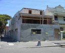
FORMER KENSINGTON GLUE WORKS
1-39 HOBSONS ROAD KENSINGTON, MELBOURNE CITY
FORMER KENSINGTON GLUE WORKS
1-39 HOBSONS ROAD KENSINGTON, MELBOURNE CITY
All information on this page is maintained by Heritage Victoria.
Click below for their website and contact details.
Victorian Heritage Inventory
On this page:
Statement of Significance
What is significant?
The archaeological features and deposits that compose the remains of the former Kensington Glue Works factory complex from the 1870s until the late 20th century.
How is it significant?
The site is historically, socially and archaeologically significant to the State of Victoria.
Why is it significant?
The Former Kensington Glue Works is of social, historical, and potential archaeological significance to the state of Victoria because of its role in early manufacturing. The currently standing, interwar period buildings played a key role in the production of glue and gelatine from the early 20th century, the latter of which was internationally recognised through the exportation by the Davis Gelatine Company from the 1920s until the 1950s. Any original remains from the 19th century former Glue Works can also add to our understanding of early manufacturing practices in Melbourne.
Any archaeological remains of the former Kensington Glue Works could also provide knowledge of early manufacturing practices from the 19th and 20th centuries in Victoria. Associated themes, as set out in Victoria’s Framework of Historical Themes, for the Glue Works include ‘Processing raw materials’ (5.1) and ‘Developing a manufacturing capacity’ (5.2).
Show more
Show less
-
-
-
-
TERRACE
 Victorian Heritage Register H0077
 -
TERRACE
Victorian Heritage Register H0081
-
FORMER NEWMARKET SALEYARDS AND ABATTOIRS
Victorian Heritage Register H1430
-
-