Tarneit RAAF Bombing Range
Springhill Road TARNEIT, WYNDHAM CITY
-
Add to tour
You must log in to do that.
-
Share
-
Shortlist place
You must log in to do that.
- Download report
Statement of Significance
This record has minimal details. Please look to the right-hand-side bar for any further details about this record.
-
-
Veterans Description for Public
Tarneit RAAF Bombing Range - Veterans Description for Public
From the 1920s, military aviation associated with the Australian Air Force has played a major role in the history of the municipality. Much of this activity has related to the establishment of Air Force bases at Point Cook and Laverton, two of the best known in Australia and that have an important place not only in the history of the Shire, but also in the history of the Commonwealth of Australia.
A paddock, located on the Staughtons' Eynesbury property west of Werribee River, was used as a bombing range by the RAAF during the Second World War. A map of the lands in the Eynesbury Woodhouse Pastoral Company estate, supplied by John Todd, shows the bombing range, 180 acres located west of the Werribee River and east of Mt. Mary Road. The quadrant huts associated with the range were located at three points: opposite Cobbledicks' Ford Road in Crown Allotment A, Section XX, Parish of Werribee; at the end of Mount Mary Road in Crown Allotment B, Section XXIV, Parish of Werribee; and in Crown Allotment A, Section XXIV, Parish of Werribee. The first two huts were located south of the creek and the third was north of the Creek. The site of the quadrant huts was marked by Jack Smith, who lived just across the river.Smith described the quadrant huts, which were used to observe the bombing operations on the site, as being made of timber packing cases, measuring about 2.5 x 2 metres. The packing cases had been earlier used to transport aircraft parts. Sleeping quarters for men working on the site were also built here. These quarters were constructed of timber and measured about 4 x 9 metres. In the years around 1942-43, RAAF planes flew over and dropped practice bombs on the site. The bombs were about 500mm long and released chemical smoke when they struck the ground so they could be easily seen. It is believed that one USAF plane mistook this bombing range for a gunnery range at where more powerful ammunition was used, and dropped a powerful bomb on the bombing range that caused damage to this site and surrounding buildings.2
-
-
-
-
-
WERRIBEE RAILWAY STATIONVictorian Heritage Register H1309
-
CALLANAN'S CHEMISTVictorian Heritage Register H1956
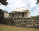
-
FORMER DAIRY SITEVictorian Heritage Inventory
-
-