Back to search results
Specimen Hill Precinct
LESTER STREET, EAGLEHAWK, GREATER BENDIGO CITY
Specimen Hill Precinct
LESTER STREET, EAGLEHAWK, GREATER BENDIGO CITY
All information on this page is maintained by Greater Bendigo City.
Click below for their website and contact details.
Greater Bendigo City

Specimen Hill Precinct

On this page:
Statement of Significance
What is significant?
How is it significant?
Why is it significant?
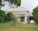
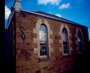
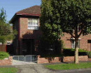
Specimen Hill includes some remnants of walling, houses and commercial and community buildings as well as evidence of distinct phases in mining operations. It is a valuable reminder of the broad complex of houses, industrial and communal structures which typified the mining districts of Bendigo and Eaglehawk. Although it now longer has that more dense urban character which was once a part of the townscape, the scattered surviving landforms and buildings are sufficiently close together and retain visual links which give a strong representation of the character of the is part of the field in the most active years of mining.
Mining Significance:
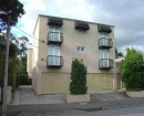
The economic significance of the Virginia Hill mine is summarized in another paper. The surviving buildings are the most important physical evidence of this activity, enhanced by the sand dumps and mining remnants to the west of Sailors Gully Road and forming a picturesque backdrop to the houses here and along Reef Street, Mount Street and elsewhere. Their humble character, surviving stone walls and gardens (8 Reef Street), demonstrate a working class life style now long gone, but one which was the basis for Eaglehawk's existence and which survives more dramatically here than anywhere else in the Borough.
Mining Significance:
The economic significance of the Virginia Hill mine is summarized in another paper. The surviving buildings are the most important physical evidence of this activity, enhanced by the sand dumps and mining remnants to the west of Sailors Gully Road and forming a picturesque backdrop to the houses here and along Reef Street, Mount Street and elsewhere. Their humble character, surviving stone walls and gardens (8 Reef Street), demonstrate a working class life style now long gone, but one which was the basis for Eaglehawk's existence and which survives more dramatically here than anywhere else in the Borough.
Show more
Show less
-
-
-
-
-
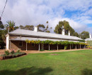
EAGLEHAWK TOWN HALL, MECHANICS INSTITUTE AND TWO HMVS NELSON CANNONS
 Victorian Heritage Register H0713
 -
CATHERINE REEF UNITED COMPANY GOLD MINE
Victorian Heritage Register H1232
-
EAGLEHAWK COURT HOUSE, MAGISTRATES COURT AND LOCK-UP
Victorian Heritage Register H1401
-
-