Back to search results
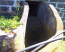
GAZETTE WOOLSHED ROAD STONE STRUCTURES
GAZETTE LANE GAZETTE, SOUTHERN GRAMPIANS SHIRE
GAZETTE WOOLSHED ROAD STONE STRUCTURES
GAZETTE LANE GAZETTE, SOUTHERN GRAMPIANS SHIRE
All information on this page is maintained by Heritage Victoria.
Click below for their website and contact details.
Victorian Heritage Inventory
On this page:
Statement of Significance
This record has minimal details. Please look to the right-hand-side bar for any further details about this record.
Show more
Show less
-
-
-
-
GAZETTE WOOLSHED ROAD STONE STRUCTURES
 Victorian Heritage Inventory
-
-