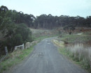
ALLANVALE TOLL GATE SITE
1301 WESTERN HIGHWAY GREAT WESTERN, NORTHERN GRAMPIANS SHIRE
-
Add to tour
You must log in to do that.
-
Share
-
Shortlist place
You must log in to do that.
- Download report
Statement of Significance
This record has minimal details. Please look to the right-hand-side bar for any further details about this record.
-
-
ALLANVALE TOLL GATE SITE - History
This location is somewhat confusingly described thus in the Heritage Victoria Listing 1 of theartefactual remains of the site:
"Location
103 Western Highway GREAT WESTERN, NORTHERN GRAM PlANS SHIRE"
"What is Significant?
The former tollgate, now located at 316 Glenelg Highway, Delacombe is believed to date fromc1864, and was previously located on the Glenelg Highway at Smythes Creek. It comprises one of two leaves of a wide double timber gate that now serves as the entrance to a farm. The gate is rectangular and constructed of a wooden frame featuring eight panels with eight internal lightweight timbers arranged in a cross pattern.
The gate is affixed to a much later post (made of a tree stump). The other half of the gate in place is modern metal. Neither of these elements are of significance. "
In the above, the initially stated current location of the tollgate at '103 Western Highway' does not match the current location provided two lines later as "316 Glenelg Highway, Delacombe". Neither does the stated original location of function ("on the Glenelg Highway at Smythes Creek") match the lengthier description of historical function provided by Heritage Victoria several lines later. No mention is made of Glenelg in the extract from Heritage Victoria below - which in fact it seems to clearly demonstrate a continuous connection with the Great Western District. "The toll gate across the new highway near Great Western early in 1867 prompted the local correspondent of the Ararat Advertiser to complain of 'the "Toll" nuisance' and call for 'the total annihilation of tolls.' On 23 December 1869 a notice appeared in the Stawell newspaper "J. Steele has received instructions to sell the Toll gate on the main road at Armstrongs, by Public Auction, at the Commercial Assembly Rooms, Reefs, at Noon on Friday, the 24th December 1869, for a period of twelve months, from the 1st January 1870 to the 31st December 1870 inclusive ... " Confusingly a report on 25 December 1869 stated "Mr. J. Steele yesterday submitted at auction the Allanvale Toll-gate for the 5tawell shire Council, when the highest bidder was Mr. John Williams, to whom it was knocked down at £40 per month." Although Armstrongs and Allanvale are some distance apart at that time both names may have referred to the same area. Charles Grant was appointed Toll Collector at £2 lOs a week. The gate operated until July 1876 when tolls were abolished in Victoria and during that time there were numerous complaints of travellers taking back roads
ALLANVALE TOLL GATE SITE - Interpretation of Site
The Allanvale toll gate site was initially identified from an 1875 lead map, georeferenced over modern cartography, with the registered remains being identified in a subsequent field survey at the historical location. Material identified at the site was likely structural in function (red brick, stone) however no in situ features were able to be identified during the field survey (Feb 2012). High voltage power lines have been installed nearby and their installation may have resulted in significant subsurface disturbance to the area. Further archaeological investigation is recommended, particularly of the mound, to better interpret the site.
ALLANVALE TOLL GATE SITE - Historical Significance
Any potential physical remains , at the site of the Allanvale Tollgate would be of local historical significance as a tangible link to the economic and social history of the local area.
ALLANVALE TOLL GATE SITE - Archaeological Significance
The site of the Allanvale Tollgate is of low archaeological significance due to a lack of any visible archaeological features or deposits however there is low to moderate archaeological potential for features or deposits to be associated with the mound. The extent of any disturbance from the installation of powerlines through the area is difficult to confirm and it is possible that the mound is the result of the removal/clearance of surface sediment during construction. The adjacent road reserve also has low archaeological potential to contain further archaeological remains however the ground surface was obscured by thick vegetation during the survey
Heritage Inventory Description
ALLANVALE TOLL GATE SITE - Heritage Inventory Description
Site comprises a small area of unidentified exotic vegetation, a diffuse scatter of redbrick, glass, bluestone and granite surrounding a small linear mound containing similar material 2m x .9m in size.
-
-
-
-
-
ALLANVALE TOLL GATE SITE
 Victorian Heritage Inventory
 -
MCKAY FAMILY HOMESTEAD
 Victorian Heritage Inventory
 -
Great Western Honour Roll
 Vic. War Heritage Inventory
-
-


