Monterey Pine
126, 128, 130, 132 and 138 High St DONCASTER, Manningham City
![Manningham City](http://api.heritagecouncil.vic.gov.au/img/owner_icons/8.gif)
-
Add to tour
You must log in to do that.
-
Share
-
Shortlist place
You must log in to do that.
- Download report
![Manningham Heritage Garden & Significant Tree Study 2006 Manningham Heritage Garden & Significant Tree Study 2006](https://vhd.heritagecouncil.vic.gov.au/vhd-images/places/000/016/664.jpg)
![Manningham Heritage Garden & Significant Tree Study 2006 Manningham Heritage Garden & Significant Tree Study 2006](https://vhd.heritagecouncil.vic.gov.au/vhd-images/places/000/016/666.jpg)
Statement of Significance
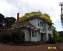
The row of 35 Pinus Radiata along the eastern side of High Street, Doncaster are considered to be locally significant as a remnant windbreak planting dating back to the orcharding history of Doncaster. Positioned within the front gardens of houses 126-138, the trees form a strong element in the streetscape.
-
-
Monterey Pine - Physical Conditions
Private land
Melway Ref: 33 A11-B10
Setting/Position: A row of approximately 35 trees on the east side of High Street, scattered along the front boundaries of houses 126, 128, 130, 132, 136 & 138 High Street. A number of these appear to be self-sown seedlings.
No. of trees: 35
Height: 15-20m (average)
Canopy Spread (m) E-W: 8m (average)
N-S: 8m (average)
DBH: Varied
Approx. Age of Tree: 80 years
TPZ: 10.5m CRZ: 3.0m
Should development occur within 30m of any of the trees, individual trees affected should have TPZ's calculated. Assess using the Matheny & Clark method of calculation, based on individual trunk diameters and trees with moderate tolerance to development pressures.
Category of Significance:
Location or context
Historic value
Level of Significance: Local
History: The row of pine trees is evident at a large size in the 1945 aerial photograph, where at their northern extremity they also continued onto the other side of High Street. Orchards were located to the trees' east. While the trees once formed a complete row with only one break, there are now a large number of gaps within the plantings.
Source: 1945 - aerial photograph
Health:
Dead wood
Dieback
Rot
Other/Notes: Minor canopy deadwood, with some dead limbs. Some canopy dieback, particularly within seedlings. Minor rot associated with pruning points.
Health Rating: 3
Threats/Risks to Tree: Any future works to the streetscape and/or residential front gardens. High street has recently undergone quite significant streetscape works with road widening; however it is unknown whether any trees were lost during this process.
Hazards/Risks:
Irregular branch structure
Other/Notes: Some crossed limbs and dead branches within canopies.
Structure Rating: 4
Recorded by: Susan Tallon
Date: 21-01-03
ID Confirmed: Susan Tallon
Heritage Study and Grading
Manningham - Heritage Garden & Significant Tree Study - Stage 2
Author: John Patrick Pty Ltd
Year: 2006
Grading:
-
-
-
-
-
WINTER PARK CLUSTER HOUSINGVictorian Heritage Register H1345
-
TULLAMOREManningham City
-
House at 478 - 482 Doncaster RoadManningham City
-
-