Back to search results
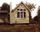
LONG TUNNEL MINE - WELL'S PADDOCK
EAST METCALFE-LANGLEY ROAD METCALFE EAST, MOUNT ALEXANDER SHIRE
LONG TUNNEL MINE - WELL'S PADDOCK
EAST METCALFE-LANGLEY ROAD METCALFE EAST, MOUNT ALEXANDER SHIRE
All information on this page is maintained by Heritage Victoria.
Click below for their website and contact details.
Victorian Heritage Inventory
On this page:
Statement of Significance
This record has minimal details. Please look to the right-hand-side bar for any further details about this record.
Show more
Show less
-
-
-
-
REDESDALE RAILWAY
 Victorian Heritage Inventory
 -
BLACK CREEK BRIDGE 2
Victorian Heritage Inventory
-
LONG TUNNEL MINE - WELL'S PADDOCK
Victorian Heritage Inventory
-
-