Back to search results
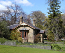
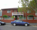
Monbulk Homestead
Ryans Rd (Nixon's Road, or Monbulk Creek Road), Lysterfield VIC 3156 - Property No S03535
Monbulk Homestead
Ryans Rd (Nixon's Road, or Monbulk Creek Road), Lysterfield VIC 3156 - Property No S03535
All information on this page is maintained by Yarra Ranges Shire.
Click below for their website and contact details.
Yarra Ranges Shire

Monbulk Homestead

On this page:
Statement of Significance
The remains of the old Monbulk Homestead have high local significance for their associations with the Dargan family, early district pastoral pioneers, who acquired the Monbulk run in 1850. The Monbulk Pre-Emptive Right property is of significance as one of a large number of such properties in Yarra Ranges Shire. The property has historical significance, too, for its associations with the Nixons and Brandts, prominent district families.
Show more
Show less
-
-
-
-
Eloera Homestead
 Yarra Ranges Shire
 -
Monbulk Homestead
Yarra Ranges Shire
-
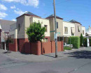
Lysterfield Valley
 National Trust
-
-