Back to search results
189-229 LYTTLETON TERRACE
189-229 LYTTLETON TERRACE BENDIGO, GREATER BENDIGO CITY
189-229 LYTTLETON TERRACE
189-229 LYTTLETON TERRACE BENDIGO, GREATER BENDIGO CITY
All information on this page is maintained by Heritage Victoria.
Click below for their website and contact details.
Victorian Heritage Inventory
On this page:
Statement of Significance
This record has minimal details. Please look to the right-hand-side bar for any further details about this record.
Show more
Show less
-
-
-
-
ANNE CAUDLE CENTRE, BENDIGO BENEVOLENT ASYLUM AND LYING-IN HOSPITAL
 Victorian Heritage Register H0992
 -
BENDIGO TOWN HALL
Victorian Heritage Register H0117
-
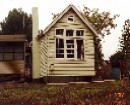
SPECIMEN COTTAGE
Victorian Heritage Register H1615
-
-