Back to search results
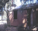
SWING BRIDGE ROAD MINING SITE
POTTS POINT ROAD TARADALE, MOUNT ALEXANDER SHIRE
SWING BRIDGE ROAD MINING SITE
POTTS POINT ROAD TARADALE, MOUNT ALEXANDER SHIRE
All information on this page is maintained by Heritage Victoria.
Click below for their website and contact details.
Victorian Heritage Inventory
On this page:
Statement of Significance
This record has minimal details. Please look to the right-hand-side bar for any further details about this record.
Show more
Show less
-
-
-
-
SWING BRIDGE ROAD HOMESTEAD RUIN
 Victorian Heritage Inventory
 -
COLIBAN RIVER SWING BRIDGE REMAINS
Victorian Heritage Inventory
-
SWING BRIDGE ROAD MINING SITE
Victorian Heritage Inventory
-
-