Eucalyptus camaldulensis
Yandell Street,, CASTLEMAINE VIC 3450 - Property No T12131

Statement of Significance
Important landmark in historic town
Particularly old
Historical value
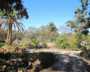
This magnificent Eucalyptus camaldulensis (River Red Gum) stands at the junction of Barkers and Forest Creeks. It is marked by an X and the notation "the late Mr Howe's marked tree" on the 1854 plan of the town of Castlemaine. The tree was marked during an 1840s pre gold rush survey and is adjacent to the site of the Gold Commissioner's Camp established in the early 1850s.
William Weston Howe was the Government Surveyor employed during the 1840's to locate the various headwaters of the Loddon River in the County of Talbot. Howe was taken ill and died near Mt Cole in early January 1849. He was buried in Franklinford cemetery. On the occasion of the grave re-dedication in 2004, the government's Senior Surveyor, Kevin Flynn, was able to verify the blaze on the marked tree.
Girth (m): 6.21 at 1.4
Spread (m): E-W 33.6; N-S: 29.7
Height: 26.5m
Estimated Age (yrs): 200 - 300+
Condition: Good
Measurements: 23/10/2010
Girth (m): 7.5
Spread (m):30
Height (m): 27
Condition: Good
Estimated Age (yrs): 200 - 300+
Access: Unrestricted
Classified: 23/02/2009
-
-
-
FLOUR MILL
 Victorian Heritage Register H0395
 -
BANK OF NEW SOUTH WALES
Victorian Heritage Register H0131
-
FORMER CBC BANK
Victorian Heritage Register H0712
-
-