Mount Pleasant / Golden Point

Statement of Significance
The Mount Pleasant/Golden Point Precinct is historically significant at a LOCAL level (AHC criterion A,1,3 and H.1).
(a) the place's importance in the course, or pattern, of Australia's natural or cultural history;
(a3) importance in exhibiting unusual richness or diversity of built landscapes and cultural features;
(a4) & (h1) importance for association with events, developments, cultural phases and individuals which have had a significant role in the human occupation and evolution of the region.
The Precinct is significant as it illustrates the transition from early alluvial mining practices to highly sophisticated large engineering companies involved in quartz mining that sustained Ballarat's prosperity well into the 20th and 21st century. It is associated with three different phases of gold mining in the Ballarat region, alluvial (1851-52), Deep Lead (1853-75) and quartz mining (1854-1914). To the north east on Golden Point, lies Old Post Office Hill, the scene of the original gold discovery, which formed together with the flats along the Yarrowee Creek, the earliest and one of the richest alluvial fields on the Ballarat goldfields. The area was part of the main diggings area of Ballarat, although rivaled by Eureka and Canadian Gully fields shortly afterwards. The hilly spur of Golden Point, Mt Pleasant and the White Horse Ranges stretching south, gave rise to a series of gullies and rich Deep Leads that ran both east towards the main north-south Canadian Lead and west to Yarrowee Creek and the north-south Golden Point Lead. This latter Lead was the main stream under the basalt plateau of West Ballarat that ran south to Sebastopol. By the 1850s Golden Point was seriously mined for quartz, especially the area called Gum Tree Flat.
The Precinct is also historically significant for its associational links with the development of mining law related to underground mining practices. The many disputed claims in the Precinct gave rise to a substantial growth in legal chambers and fine architectural buildings that lined Lydiard Street by 1860s. Many of these mining claims were the subject of landmark mining legal decisions. The decisions covered the changing regulations that governed alluvial diggers and the practice of shepherding, the introduction of Frontage Regulations that controlled the register and sizes of claims allowing small parties of men to introduce larger scale mining activities that were vital to Deep Lead mining operations. It paved the way for large scale operations associated with quartz mining within the area that called for outside financial, organizational and engineering skills.
The Precinct is also historically important for its ability to add to our understanding of the many layering and complexities associated with the steady influx of a cosmopolitan mining population, including a large Chinese group of miners, in the development of an increasingly more formal built environment that became dominated by Cornish and Welsh miners, experts in quartz mining. In particular the area is associated with the Welshman, Thomas Jones who mined the No 1 Lannberris Mine, and pioneered the techniques of early quartz mining. The early road system and subsequent consolidation as a residential area from the 1850s followed a typical pattern of developing land left vacant by mine closures. In consequence, the urban fabric and local roads developed into a distorted grid that reflected the underlying auriferous deposits and geology of the area, and aspirations of a changing local community. The majority of roads were laid out in 1870s and 1880s. The Precinct is also associated with later development following the electrification in 1904 of the former horse-drawn trams and the extension of their route to include a spur along Barkly Street to the Cobden Street intersection in Mount Pleasant.
The potential for archaeological investigation extends to the former Old Post Office Hill and former Chinese miners village.
The Mount Pleasant/Golden Point Precinct is architecturally significant at a LOCAL level (AHC criteria D.2, E.1).
(d) its importance in demonstrating the principal characteristics of: (i) a class of Australia's Cultural places; or (ii) a class of Australia's cultural environments (including way of life, custom, process, land-use, function, design or technique);
(e) its importance in exhibiting particular aesthetic characteristics valued by a community or cultural group.
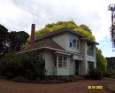
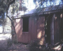
The Precinct is a significant, highly heterogeneous mix of mid 19th century to early 20th century residential, commercial and institutional buildings developed within an intensely worked gold mining area. The predominance of residential buildings is a powerful illustration of the impact of new mining laws that were introduced following the nearby Eureka Rebellion and Commission of Inquiry in 1854 and 1855. This included permitting residential development to co-exist alongside industrial mining activities. The resulting security of tenure made possible by the introduction of Miners Rights (later termed Residential Area Right Leases) encouraged a more permanent settlement to occur. The many original and intact residential, commercial, and cultural/community development of the Mount Pleasant/Golden Point are important as a collection of buildings that testify to an area in a state of constant change between 1850s and the 1940s. Generally, as miners lived within close proximity to their mine operations, the wide range of sizes and styles of houses in close juxtaposition reflects the status and occupation of their residents, with wealthy mine managers and owners acquiring the largest and best sites for their homes. The most rudimentary cottages reflect the transitory nature of the early mining settlement in the northern area around Golden Point. In contrast, the predominately substantial later Victorian and Edwardian residences are associated with quartz mining and are dispersed evenly throughout the precinct. There is a strong correlation between different sized allotments, different architectural styles, various front and side setbacks, changing orientation of dwellings and apparent randomness in the location of cultural buildings and parks, with different types, prosperity, duration and location of former gold mining operations, and the subsequent speculative development that followed. In contrast with West Ballarat, the cultural significance of the architecture fabric of the precinct reflects the impact and vagaries of alluvial, Deep Lead and quartz gold mining operations, rather than an over arching urban planning ideal.
The Mount Pleasant/Golden Point Precinct is aesthetically significant at a LOCAL level (AHC criteria D.2, E.1).
(d) its importance in demonstrating the principal characteristics of: (i) a class of Australia's Cultural places; or (ii) a class of Australia's cultural environments (including way of life, custom, process, land-use, function, design or technique);
(e) its importance in exhibiting particular aesthetic characteristics valued by a community or cultural group.
The important visual qualities of the heritage landscape of Golden Point and its surrounds in conjunction with the former Flats of Yarrowee Creek, illustrates the evolution and development of a largely spontaneous unplanned historic 19th century mining precinct, a contextual landscape for the major historic mining tourist site of Sovereign Hill. In particular these qualities include the complex views from the elevated undulating hills of Mt Pleasant/Golden Point and the White Horse Ranges across the alluvial flats inclusive of Winters, Golden Point, Gum Tree Flats and Yarrowee Creek through the Precinct to other parts of Ballarat; especially the escarpment defining the edge of the basalt plateau of West Ballarat. The area itself forms a visually important contextual setting from many historic vantage points around the City of Ballarat. There are panoramic views of the area from the escarpment as well as Camp Street, the site of the former Police Camp, which overlooked the generally centralized alluvial diggings. As there are no large scale developments that dominate the skyline, early viewscapes remain, and it is possible to clearly see different aspect of the areas that were the subject of mid 19th century illustrations depicting life on the early gold diggings. The area provides a unique visual insight into the architectural aspirations that represent the changing life styles of different types of miners towards residential buildings during the transition from alluvial, Deep Lead and underground quartz mining. These examples include differing treatment of civic infrastructure development, including the design of road layout, kerbs, gutters and street planting. Other important aesthetic qualities include notably the corner shops, Grapes Hotel along Grant Street; Mount Pleasant and former Golden Point schools; Pearces Park and rotunda; and the tree-lined ridge of Magazine Hill.
The Mount Pleasant/Golden Point Precinct is socially significant at a LOCAL level (AHC criterion G.1).
(g) the place's strong or special association with a particular community or cultural group for social, cultural or spiritual reasons.
The Precinct is recognized and highly valued by the local community for residential, commercial, cultural, religious, and recreational reasons. The area is socially and culturally significant for the legacy of paintings, illustrations and wealth of historical records that document the gold mining history of the area and its many mining disputes.
The Central Ballarat Precinct is scientifically significant at a LOCAL level (AHC criteria C and F).
(c) its potential to yield information that will contribute to an understanding of Australia's natural or cultural history;
(f) importance for its technical, creative, design or artistic excellence, innovation or achievement.
The Precinct is of importance for contributing to a history of the infrastructure development of this area particularly as identified by the extensive network of significantly intact bluestone spoon or channel drains, and bluestone inverted channel gutters with bluestone pitcher kerbs. The use of bluestone pitchers as the principal material to form much of this engineering infrastructure also demonstrates an early, and now rarely used construction technology, as well as the excellence of traditional craftsmanship. Many buildings and associated structures also demonstrate high standards of construction and craftsmanship.
-
-
-
-
-
MITRE TAVERN
 Victorian Heritage Register H0464
 -
MELBOURNE SAVAGE CLUB
Victorian Heritage Register H0025
-
FORMER LONDON CHARTERED BANK
Victorian Heritage Register H0022
-
-