account anchor arrow-down arrow-left-thick arrow-right-solid arrow-right-thick arrow-right arrow-up audio bookmark-solid bookmark close compass dashboard delete download email explore hamburger help home image locate login marker-icon marker-multiple marker-single minus note options pause pdf play plus print refine search share shortlist signup skip sort-detail sort-image sort-list star tick timeline tour vhr welcome zoom
  • Home
  • Skip to content
  • Create account
  • Log in
Victorian Heritage Database
Search in:
  • Advanced places/objects search
  • Advanced shipwreck search
  • Search tips

Browse heritage places

  • and

Browse Shipwrecks

  • and
  • and

Browse Tours

  • Recommended tours
  • Contributed tours
  • Create your own tour
Account login
Create account

Browse heritage places

  • and

Browse Shipwrecks

  • and
  • and

Browse Tours

  • Recommended tours
  • Contributed tours
  • Create your own tour
Back to search
  • Save Search
    You must log in to do that.
  • Share Search
  • Download Search

    The download will only include records from the current search page. You can increase the number of records to download by changing the number of 'listings per page' at the bottom of this page. Note that the maximum number of records that can be listed per page is 300. The download may exceed the number of records listed as any 'nested' records that have met the search criteria will also download.

    Download file (.xls)
Search results:
Back to search

Refine results by

    • SOUTHERN GRAMPIANS SHIRE (43)
    • MERRI-BEK CITY (39)
    • GLENELG SHIRE (31)
    • MOONEE VALLEY CITY (26)
    • BOROONDARA CITY (17)
    • MELBOURNE CITY (15)
    • GREATER GEELONG CITY (12)
    • YARRA CITY (11)
    • HOBSONS BAY CITY (9)
    • MELTON CITY (9)
    • MOYNE SHIRE (9)
    • NILLUMBIK SHIRE (8)
    • BRIMBANK CITY (7)
    • MARIBYRNONG CITY (6)
    • MOORABOOL SHIRE (6)
    • BANYULE CITY (5)
    • MORNINGTON PENINSULA SHIRE (5)
    • STONNINGTON CITY (5)
    • COLAC OTWAY SHIRE (4)
    • CORANGAMITE SHIRE (4)
    • GOLDEN PLAINS SHIRE (3)
    • CARDINIA SHIRE (2)
    • HUME CITY (2)
    • PORT PHILLIP CITY (2)
    • PYRENEES SHIRE (2)
    • SOUTH GIPPSLAND SHIRE (2)
    • WELLINGTON SHIRE (2)
    • BAYSIDE CITY (2)
    • CASEY CITY (1)
    • DAREBIN CITY (1)
    • ALPINE SHIRE (1)
    • HEPBURN SHIRE (1)
    • HORSHAM RURAL CITY (1)
    • MACEDON RANGES SHIRE (1)
    • MANNINGHAM CITY (1)
    • MOIRA SHIRE (1)
    • MOUNT ALEXANDER SHIRE (1)
    • MURRINDINDI SHIRE (1)
    • BASS COAST SHIRE (1)
    • QUEENSCLIFFE BOROUGH (1)
    • STRATHBOGIE SHIRE (1)
    • SURF COAST SHIRE (1)
    • SWAN HILL RURAL CITY (1)
    • WEST WIMMERA SHIRE (1)
    • WHITTLESEA CITY (1)
    • WODONGA CITY (1)
    • Victorian Heritage Register (110)
    • Southern Grampians Shire (41)
    • Merri-bek City (37)
    • Moonee Valley City (26)
    • Glenelg Shire (20)
    • Boroondara City (13)
    • Hobsons Bay City (9)
    • Nillumbik Shire (8)
    • Melton City (7)
    • Yarra City (6)
    • Maribyrnong City (5)
    • Brimbank City (5)
    • Moorabool Shire (4)
    • Vic. War Heritage Inventory (4)
    • Stonnington City (3)
    • Cardinia Shire (2)
    • Darebin City (1)
    • South Gippsland Shire (1)
    • Banyule City (1)
    • Pre-separation Colonial Georgian 1836-50 (39)
    • Interwar Period (c.1919-c.1940) (33)
    • Pre-separation Colonial Vernacular 1836-50 (24)
    • Victorian Period (1851-1901) (17)
    • Interwar Period (c.1919-c.1940) Old English (13)
    • Interwar Period (c.1919-c.1940) American Bungalow (10)
    • Federation/Edwardian Period (1902-c.1918) (8)
    • Interwar Period (c.1919-c.1940) Moderne (7)
    • Federation/Edwardian Period (1902-c.1918) Domestic Queen Anne (5)
    • Victorian Period (1851-1901) Regency (4)
    • Victorian Period (1851-1901) Free Classical (2)
    • Federation/Edwardian Period (1902-c.1918) Bungalow (2)
    • Interwar Period (c.1919-c.1940) Stripped Classical (2)
    • Federation/Edwardian Period (1902-c.1918) Art-Nouveau (2)
    • Pre-separation Primitive Settlement 1788-1835 (1)
    • < - 1849 (303)
    • Registered place (137)
    • Registered archaeological place (21)
    • Registered object integral to a registered place (6)
    • Registered object (3)
    • Registered archaeological artefact (1)
    • 6. Building towns cities and the garden state (9)
      • 6.1 Establishing settlements in the Port Phillip District (5)
      • 6.2 Creating Melbourne (3)
      • 6.3 Shaping the suburbs (2)
      • 6.7 Making homes for Victorians (3)
    • 2. Peopling Victoria's places and landscapes (7)
      • 2.1 Living as Victoria's original inhabitants (1)
      • 2.2 Exploring surveying and mapping (1)
      • 2.3 Adapting to diverse environments (1)
      • 2.5 Migrating and making a home (3)
      • 2.6 Maintaining distinctive cultures (3)
      • 2.7 Promoting settlement (1)
      • 2.8 Fighting for identity (2)
    • 3. Connecting Victorians by transport and communications (5)
      • 3.1 Establishing pathways (2)
      • 3.2 Linking Victorians by water (1)
      • 3.3 Linking Victorians by rail (1)
      • 3.4 Linking Victorians by road in the 20th century (2)
      • 3.5 Travelling by tram (1)
      • 3.7 Establishing and maintaining communications (1)
    • 5. Building Victoria's industries and workforce (5)
      • 5.2 Developing a manufacturing capacity (1)
      • 5.3 Markets and retailing (1)
      • 5.5 Banking and finance (1)
      • 5.7 Catering for tourists (1)
      • 5.8 Working (1)
    • 4. Transforming and managing the land (3)
      • 4.3 Grazing and raising livestock (2)
      • 4.4 Farming (1)
    • 7. Governing Victorians (3)
      • 7.3 Maintaining law and order (1)
      • 7.4 Defending Victoria and Australia (2)
    • 8. Building community life (2)
      • 8.2 Educating people (1)
      • 8.3 Providing health and welfare services (2)
    • 9. Shaping cultural and creative life (2)
      • 9.1 Participating in sport and recreation (1)
      • 9.3 Achieving design and artistic distinction (1)
    • Residential buildings (private) (139)
      • House (78)
      • Homestead building (32)
      • Stables (16)
      • Cottage (15)
      • Shop (11)
      • Mansion (6)
      • Duplex (4)
      • Flat (4)
      • Fence/Wall (4)
      • Gatehouse (4)
      • Residential Precinct (4)
      • Hut/Shack (3)
      • Artefacts/Relics (3)
      • Residence (3)
      • Gate (2)
    • Farming and Grazing (80)
      • Homestead Complex (59)
      • Stables (16)
      • Woolshed/Shearing Shed (9)
      • Shed (7)
      • Staff quarters (5)
      • Gatehouse (4)
      • Pastoralism (4)
      • Shearers' Quarters (3)
      • Stockman's Hut (3)
      • Stone wall (3)
      • Barn (3)
      • Artefacts/Relics (3)
      • Sheep Dip/Sheep Wash (2)
      • Silo (2)
      • Stock Well/Tank (2)
      • Woolscour (2)
      • Warehouse/storage area (2)
      • Agriculture (2)
      • Farm (2)
      • Gate (2)
      • Kitchen (2)
      • Orchard (2)
      • Outstation (2)
      • Smoke House (1)
      • Yarding/ Loading Facility (1)
      • Abattoir/ Meat Processing (1)
    • Commercial (30)
      • House (78)
      • Hotel (17)
      • Stables (16)
      • Shop (11)
      • Inn/Tavern (7)
      • Staff quarters (5)
      • Commercial Precinct (4)
      • Office building (2)
      • Warehouse/storage area (2)
      • Bank (1)
    • Parks, Gardens and Trees (29)
      • House (78)
      • Garden Residential (10)
      • Planting exotic (9)
      • Lake/ Pond (4)
      • Statue (3)
      • Tree (3)
      • Tree groups - avenue (3)
      • Trees of social, historic or special significance (3)
      • Urban Park (2)
      • Gate (2)
    • Landscape - Cultural (20)
      • Historic Landscape (9)
      • Other - Landscape - Cultural (8)
      • Cultural Feature (3)
    • Religion (18)
      • Church (17)
      • Religious Objects (movable) (5)
      • Church Hall (3)
      • War Memorial (2)
      • Presbytery/Rectory/ Vicarage/Manse (2)
      • Sunday School (2)
    • Manufacturing and Processing (17)
      • Factory/ Plant (5)
      • Kiln Lime (3)
      • Fellmongery (2)
      • Other - Manufacturing & Processing (2)
      • Abattoir/ Meat Processing (1)
      • Blacksmith (1)
      • Kiln other (1)
      • Mill (Grain) (1)
      • Tannery (1)
    • Recreation and Entertainment (17)
      • House (78)
      • Hotel (17)
      • Inn/Tavern (7)
      • Art Gallery/ Museum (2)
    • Cemeteries and Burial Sites (15)
      • Cemetery/Graveyard/Burial Ground (11)
      • Isolated Grave/Burial Site (4)
      • Crematorium (2)
    • Transport - Road (9)
      • Stables (16)
      • Other - Transport - Road (4)
      • Road Bridge (2)
      • Trail/Track (2)
    • Military (7)
      • Stables (16)
      • Barracks & housing (2)
      • Battery (1)
      • Defence Base Naval (1)
      • Gun Emplacement (1)
      • Military Camp (1)
    • Education (7)
      • School - Private (3)
      • Office building (2)
      • Farm (2)
    • Retail and Wholesale (5)
      • House (78)
      • Shop (11)
      • Factory/ Plant (5)
    • Urban Area (5)
      • Mixed Use Precinct (4)
    • Aboriginal (5)
      • Post-contact Site (4)
      • Burial (2)
      • Historic site (2)
    • Government and Administration (5)
      • Staff quarters (5)
      • Customs House (2)
      • Office building (2)
      • Bond Store (1)
    • Law Enforcement (4)
      • Stables (16)
      • Staff Accommodation (2)
      • Police stables (2)
      • Court House (1)
      • Gaol/Lock-up (1)
    • Postal and Telecommunications (4)
      • Telegraph Station (2)
    • Transport - Water (4)
      • Lighthouse (2)
      • Wharf (2)
    • Mining and Mineral Processing (3)
      • Kiln Lime (3)
    • Exploration, Survey and Events (3)
      • Health Services (3)
        • Office building (2)
        • Hospital (2)
        • Leprosarium (2)
        • Quarantine Station (2)
        • Ambulance Station (1)
      • Monuments and Memorials (2)
        • Statue (3)
        • War Memorial (2)
      • Utilities - Electricity (2)
        • Transport - Rail (2)
          • Collections (2)
            • Community Objects (2)
          • Landscape - Natural (2)
            • Public Art (2)
              • Statue (3)
            • National Heritage Process Group (2)
              • Historic Heritage (2)
            • Maritime Industry (1)
              • Whaling Station (1)
            • Community Facilities (1)
              • House (78)
            • Heritage Inventory Site Type (1)
              • Unknown Item Group (1)

              Success

              Error

              Back to search
              • Save Search
                You must log in to do that.
              • Share Search
              • Download Search

                The download will only include records from the current search page. You can increase the number of records to download by changing the number of 'listings per page' at the bottom of this page. Note that the maximum number of records that can be listed per page is 300. The download may exceed the number of records listed as any 'nested' records that have met the search criteria will also download.

                Download file (.xls)
              Search results:
              Results filtered by: &lt; - 1849
              Displaying 176-200 of 299 records found 299 results
              Name, details and heritage listing
              Other authorities
              • ST JOHN'S ANGLICAN CHURCH

                1 Burgundy Street HEIDELBERG, Banyule City

                Banyule City

                VHR H0197
                Shortlist
                You must log in to shortlist items.
                Download

                SIGNIFICANCE: St John's Church of England, Burgundy Street, Heidelberg is of state architectural and historical significance. The building is an important, very early church, one of the…

                Shortlist
                You must log in to shortlist items.
                Download
                 
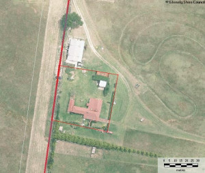
              • CASTLEMADDIE HOMESTEAD COMPLEX

                7073 PRINCES HIGHWAY, TYRENDARRA, GLENELG SHIRE

                Glenelg Shire

                Shortlist
                You must log in to shortlist items.
                Download

                Castlemaddie Homestead Complex is located on the east side of Darlot's Creek near the township of Tyrendarra. The complex consists of three separate sites, two located on the original…

                Shortlist
                You must log in to shortlist items.
                Download
                 
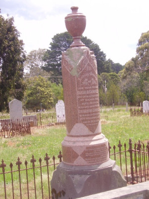
              • OLD CEMETERY

                18 OLD CEMETERY ROAD, CASTERTON, GLENELG SHIRE

                Glenelg Shire

                Shortlist
                You must log in to shortlist items.
                Download

                The Casterton Old Cemetery is located in a nine acre reserve five kilometres west of the centre of the township of Casterton, in Old Cemetery Road. It is Casterton's first Cemetery, although…

                Shortlist
                You must log in to shortlist items.
                Download
                 
              • STONY HILL

                107 BLOWHOLES ROAD, CAPE BRIDGEWATER, GLENELG SHIRE

                Glenelg Shire

                Shortlist
                You must log in to shortlist items.
                Download

                Stony Hill is located on an unmade road which is the southerly extension of Blowholes Road, approximately 1.5km south of Cape Bridgewater township. The house is a collection of several…

                Shortlist
                You must log in to shortlist items.
                Download
                 
              • CASTERTON CHURCH AND RESIDENTIAL PRECINCT (WEST HILL)

                HENTY STREET, CASTERTON, GLENELG SHIRE

                Glenelg Shire

                Shortlist
                You must log in to shortlist items.
                Download

                The Casterton Church and Residential Precinct (West Hill) is located along the Glenelg Highway, west of the central shopping area, overlooking the township. Generally, the built fabric shows…

                Shortlist
                You must log in to shortlist items.
                Download
                 
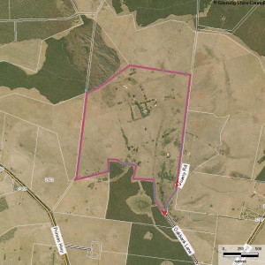
              • OAKBANK HOMESTEAD COMPLEX

                157 OAKBANK LANE, HEYWOOD, GLENELG SHIRE

                Glenelg Shire

                Shortlist
                You must log in to shortlist items.
                Download

                Oakbank Homestead, one of the oldest and most complete homestead complexes in the further Western District, is located 5.5kms due north of Heywood on the southern side of Mount Eckersley.…

                Shortlist
                You must log in to shortlist items.
                Download
                 
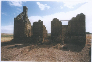
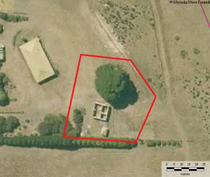
              • NATIVE POLICE BARRACKS (FORMER)

                OFF OAKBANK LANE, LOT 7 PS437883, HEYWOOD, GLENELG SHIRE

                Glenelg Shire

                Shortlist
                You must log in to shortlist items.
                Download

                The stone ruin (on Allotment 2, Section 7, Parish of Drumborg) located 7.5km due north of Heywood between Drumborg and Mount Eckersley, is almost certainly the Native Police Barracks or,…

                Shortlist
                You must log in to shortlist items.
                Download
                 
              • DRIK DRIK VILLAGE PRECINCT

                NELSON-WINNAP ROAD, DRIK DRIK, GLENELG SHIRE

                Glenelg Shire

                Shortlist
                You must log in to shortlist items.
                Download

                The small settlement at Drik Drik on the Nelson-Winnap Road, located approximately 8kms due south of Dartmoor and 35kms north-west of Heywood, was established in the mid-1860s as a result of…

                Shortlist
                You must log in to shortlist items.
                Download
                 
              • CAPE BRIDGEWATER HOMESTEAD

                65 BLOWHOLES ROAD, CAPE BRIDGEWATER, GLENELG SHIRE

                Glenelg Shire

                Shortlist
                You must log in to shortlist items.
                Download

                The Cape Bridgewater Homestead ruins are located on the Cape, overlooking Bridgewater Bay. Little remains of the stone house other than the main walls. It was single storey, symmetrical and…

                Shortlist
                You must log in to shortlist items.
                Download
                 
              • LAL LAL HOMESTEAD & HEDDITCH PRIVATE CEMETERY

                105 BRIDGEWATER LAKES ROAD, CAPE BRIDGEWATER, GLENELG SHIRE

                Glenelg Shire

                Shortlist
                You must log in to shortlist items.
                Download

                The Hedditch private cemetery is located near Lal Lal Homestead, off Bridgewater Lakes Road, at Lower Cape Bridgewater. There may have been an intention to create an aesthetic relationship…

                Shortlist
                You must log in to shortlist items.
                Download
                 
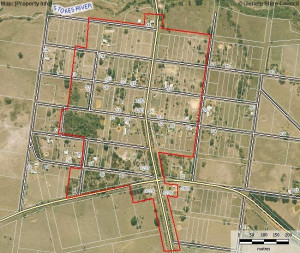
              • DIGBY VILLAGE PRECINCT

                BUCKINGHAM ST, CLARKE ST, COLDHAM ST, MCLEAN ST, RUSSELL ST, SIMPSON ST, and BOWEN ST, DIGBY, GLENELG SHIRE

                Glenelg Shire

                Shortlist
                You must log in to shortlist items.
                Download

                The present township of Digby, located on the Portland-Casterton Road, dates from the early 1860s and appears to have pre-empted the closer settlement afforded by the Land Selection Acts by…

                Shortlist
                You must log in to shortlist items.
                Download
                 
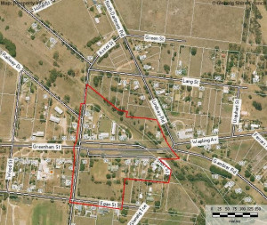
              • DARTMOOR VILLAGE PRECINCT

                PRINCES HIGHWAY, DARTMOOR, GLENELG SHIRE

                Glenelg Shire

                Shortlist
                You must log in to shortlist items.
                Download

                Dartmoor is a small village, located on the Glenelg River, on the Princes Highway. The town itself is small, and now predominately residential. Greenham Street and Wapling Avenue have long…

                Shortlist
                You must log in to shortlist items.
                Download
                 
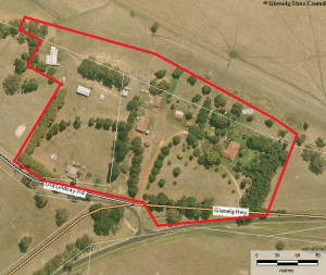
              • STRATHDOWNIE HOMESTEAD COMPLEX

                DURBRIDGES LANE, STRATHDOWNIE, GLENELG SHIRE

                Glenelg Shire

                Shortlist
                You must log in to shortlist items.
                Download

                The Strathdownie Homestead Complex, located at the intersection of the Glenelg Highway and Johnston Road, Strathdownie was established as a squatting run as early as 1845 by Captain Charles…

                Shortlist
                You must log in to shortlist items.
                Download
                 
              • RUNNYMEDE HOMESTEAD COMPLEX

                438 RUNNYMEDE ROAD, SANDFORD, GLENELG SHIRE

                Glenelg Shire

                Shortlist
                You must log in to shortlist items.
                Download

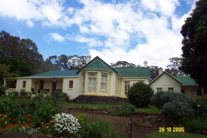
                Runnymede Homestead is a single storey asymmetrical dwelling comprised of at least three sections. It faces east and is set within an extensive garden. This historic Western District sheep…

                Shortlist
                You must log in to shortlist items.
                Download
                 
              • ROSENEATH HOMESTEAD COMPLEX

                27 WARROCK ROAD, WARROCK, GLENELG SHIRE

                Glenelg Shire

                Shortlist
                You must log in to shortlist items.
                Download

                Roseneath Homestead Complex is located overlooking the Glenelg River, approximately two kilometres north of the intersection of the Casterton-Apsley Road and the Warrock Road, near the…

                Shortlist
                You must log in to shortlist items.
                Download
                 
              • MERINO DOWNS HOMESTEAD COMPLEX

                5022 HENTY HIGHWAY, HENTY, GLENELG SHIRE

                Glenelg Shire

                Shortlist
                You must log in to shortlist items.
                Download

                The Merino Downs squatting run, along with Muntham and Sandford, was one of the first three established in the Port Phillip district of New South Wales following the encounter between the…

                Shortlist
                You must log in to shortlist items.
                Download
                 
              • WANDO VALE HOMESTEAD SITE

                366 CASTERTON-EDENHOPE ROAD, WANDO VALE, GLENELG SHIRE

                Glenelg Shire

                Shortlist
                You must log in to shortlist items.
                Download

                The Wando Vale Homestead site is located on the east side of a hill, between the Casterton-Edenhope Road and Hardie's Road, approximately 500m south east of the intersection of the Satimer…

                Shortlist
                You must log in to shortlist items.
                Download
                 
              • TREWALLA SPRINGS FARM

                919 BRIDGEWATER ROAD, PORTLAND WEST, GLENELG SHIRE

                Glenelg Shire

                Shortlist
                You must log in to shortlist items.
                Download

                Trewalla Springs Farm is located on the Bridgewater Road, some 10km east of the township of Bridgewater. The principal features of the farm include: The main house, a single-storey…

                Shortlist
                You must log in to shortlist items.
                Download
                 
              • RIFLE DOWNS

                2029 DARTMOOR-HAMILTON ROAD, DIGBY, GLENELG SHIRE

                Glenelg Shire

                Shortlist
                You must log in to shortlist items.
                Download

                Rifle Downs Homestead overlooks the Stokes River and is located at 2029 Dartmoor-Digby Road, Digby approximately 7.5km south-west of Digby and 19.0km north-west of Dartmoor. Rifle Downs…

                Shortlist
                You must log in to shortlist items.
                Download
                 
              • MERINO TOWNSHIP

                High Street,MERINO, Glenelg Shire

                Glenelg Shire

                Shortlist
                You must log in to shortlist items.
                Download

                The present township of Merino, located on the Portland -Casterton Road, dates from the early 1840s and appears to have pre-empted the closer settlement afforded by the Land Selection Acts…

                Shortlist
                You must log in to shortlist items.
                Download
                 
              • YANNARIE CHEESE & BUTTER FACTORY

                7533 PRINCES HIGHWAY, TYRENDARRA, GLENELG SHIRE

                Glenelg Shire

                Shortlist
                You must log in to shortlist items.
                Download

                The Yannarie Cheese and Better Factory is a large stone building, constructed of locally quarried and collected stone, including some bluestone and some limestone. It is located…

                Shortlist
                You must log in to shortlist items.
                Download
                 
              • Hazel Glen Homestead (complex)

                325 Middle Hut Rd Doreen, NILLUMBIK SHIRE

                Nillumbik Shire

                Shortlist
                You must log in to shortlist items.
                Download

                HERITAGE VALUE 2005 - local SIGNIFICANCE ASSESSMENT What is significant? Fabric & trees associated with: - the Victorian & Edwardian-eras - Patrick Reid, William Reid, Reid family…

                Shortlist
                You must log in to shortlist items.
                Download
                 
              • ALLUVIAL GOLD MINING REMAINS, END BLUE HOUSE ROAD

                125 BLUE HOUSE ROAD PANTON HILL, NILLUMBIK SHIRE

                Nillumbik Shire

                Shortlist
                You must log in to shortlist items.
                Download

                REVISED STATEMENT OF SIGNIFICANCE, CONTEXT, 2009 All gold mining remains (mullock heaps, shaft remains, evidence of excavations and eroded gullies) and the surrounding site to a radius of 20…

                Shortlist
                You must log in to shortlist items.
                Download
                 
              • APTED WEATHERBOARD HOUSE AND ADJACENT FORGE, 2) 1920s/1930s HOUSE AND 3) MATURE EXOTIC PLANTING

                860 COTTLES BRIDGE-STRATHEWEN RD ARTHURS CREEK, NILLUMBIK SHIRE

                Nillumbik Shire

                Shortlist
                You must log in to shortlist items.
                Download

                REVISED STATEMENT OF SIGNIFICANCE, CONTEXT, 2010 The weatherboard house, in particular the fabric dating to c1913, its underground tank and contemporaneous outbuildings and the surrounding…

                Shortlist
                You must log in to shortlist items.
                Download
                 
              • BLUESTONE COTTAGES & FORMER MORAN & CATO STORE

                197-199 EDWARD STREET, and 119 LYGON STREET, BRUNSWICK, MORELAND CITY

                Merri-bek City

                Shortlist
                You must log in to shortlist items.
                Download

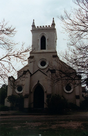
                The bluestone cottages at 197-199 Edward Street and the bluestone shop at 119 Lygon Street, Brunswick. How is it significant? The bluestone cottages at 197-199 Edward Street, Brunswick are…
                Shortlist
                You must log in to shortlist items.
                Download
                 
              • ‹
              • 1
              • 2
              • 3
              • 4
              • 5
              • 6
              • 7
              • 8
              • 9
              • 10
              • 11
              • 12
              • ›
              Account login
              Create account

              The Victorian Heritage Database is a searchable database containing information about thousands of heritage places and objects in Victoria. It includes entries for around 2400 places and objects of state significance listed in the Victorian Heritage Register as well as many places of archaeological interest included in the Victorian Heritage Inventory. Most of the database entries are local heritage places, listed on the heritage overlay from 29 local governments (out of 79 LGAs in the state). Information on heritage places from the National Trust and Victorian War Heritage Inventory is also included. Learn more.

              State Government Victoria
              • Home
              • Advanced search
              • Account login
              • Heritage Council of Victoria
              • Heritage Victoria
              • Contact us
              • Copyright disclaimer
              • Privacy statement
              • Terms & Conditions
              • Accessibility statement
              • API
              Digital Agency - Calico

              You need to be logged into to perform this action. Please login here.