-
Save Search
You must log in to do that.
-
Share Search
-
Download Search
The download will only include records from the current search page. You can increase the number of records to download by changing the number of 'listings per page' at the bottom of this page. Note that the maximum number of records that can be listed per page is 300. The download may exceed the number of records listed as any 'nested' records that have met the search criteria will also download.
Download file (.xls)
Success
Error
-
Save Search
You must log in to do that.
-
Share Search
-
Download Search
The download will only include records from the current search page. You can increase the number of records to download by changing the number of 'listings per page' at the bottom of this page. Note that the maximum number of records that can be listed per page is 300. The download may exceed the number of records listed as any 'nested' records that have met the search criteria will also download.
Download file (.xls)
-
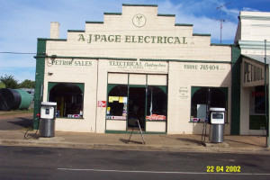
91a Bell Street PENSHURST, Southern Grampians Shire

Southern Grampians Shire
A.J Page Electrical, located at 91a Bell Street Penshurst has a large driveway and storage area to the south and to the east, a small Mount Gambier Stone building with a corrugated iron roof…
-
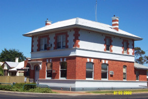
STATE SAVINGS BANK OF VICTORIA (FORMER)
59 Whyte Street, COLERAINE VIC 3315 - Property No 102

Southern Grampians Shire
The former State Savings Bank of Victoria, 59 Whyte Street, Coleraine is a two storey brick building incorporating a banking chamber with other offices on the ground floor and a manager's…
-
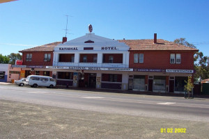
70 Whyte Street, COLERAINE VIC 3315 - Property No 108

Southern Grampians Shire
The National Hotel, formerly the Shamrock Hotel, at 70 Whyte Street, Coleraine is the second hotel building on the site. The original licence was issued in 1868. The present building was…
-
Carapook Road, CARAPOOK VIC 3312 - Property No 115

Southern Grampians Shire
Tulse Hill is a homestead complex located on the Carapook Road, near the small settlement of Carapook, 15kms northwest of Coleraine. The complex includes the house and garden, mature trees…
-
Falkenburg's Road, WANNON VIC 3301 - Property No 154

Southern Grampians Shire
The second site for the Park Hill homestead was developed in 1912, high on the opposite bank of the River Wannon from the original site which was low and damp. It is located at the southern…
-
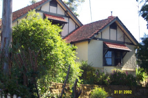
81 McKebery Street, COLERAINE VIC 3315 - Property No 078

Southern Grampians Shire
Maylands, 81 McKebery Street, Coleraine is a single storey timber house with a substantial attic storey in the picturesque Arts and Crafts style. It is located on a hill facing north and…
-
81 Church Street COLERAINE, Southern Grampians Shire

Southern Grampians Shire
The Uniting Church Manse, formerly known as Maylands, at 81 Church Street, Coleraine is a single storey, symmetrical timber house with an encircling timber verandah. It is sited on a hill,…
-
Wando Dale-Satimer Road, NAREEN VIC 3315 - Property No 146

Southern Grampians Shire
The Satimer Homestead Complex is located approximately 100 metres north of the Satimer-Wando Vale Road, overlooking the Wando River. The original homestead has been demolished, although…
-
Nareen-Coleraine Road NAREEN, Southern Grampians Shire

Southern Grampians Shire
Willaroo is a large single storey rendered brick house situated in an extensive landscaped garden. The house is approached by a long winding drive, which crosses Corea Creek, and rises…
-
Glenelg Highway COLERAINE, Southern Grampians Shire

Southern Grampians Shire
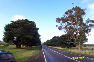
The Coleraine Avenue of Honour is located 2 kilometres west of the township of Coleraine on the Glenelg Highway. There are two sections of planting, one dedicated to those who died in active…
-
Nareen Road NAREEN, Southern Grampians Shire

Southern Grampians Shire
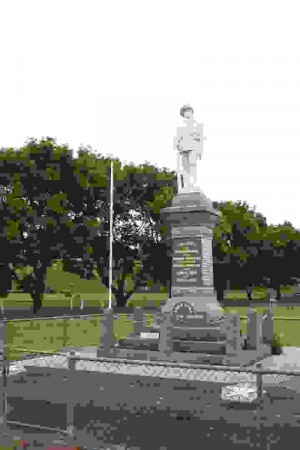
The Nareen war memorial is located on the Nareen Road, outside the local community meeting place, the Nareen Hall. It is constructed of granite, and takes the traditional form of a obelisk…
-
Port Fairy-Hamilton Road Byaduk-Penshurst Road BYADUK, Southern Grampians Shire

Southern Grampians Shire
How is it significant? The Byaduk War Memorials are of historic, social and aesthetic significance to the township of Byaduk and the Southern Grampians Shire. Why is it significant? The…
-
99 McKebery Street COLERAINE, Southern Grampians Shire

Southern Grampians Shire
The former Private Hospital, located at 99 McKebery Street Coleraine is a substantial timber building which was initially built as a private residence for Octavius Palmer, an auctioneer. The…
-
Glenelg Highway Memorial Road GLENTHOMPSON, Southern Grampians Shire

Southern Grampians Shire
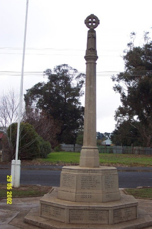
The Glenthompson War memorial, erected after the First World War (1914-1919) and added to after the Second World War (1939 -1945) is constructed of finely cast concrete blocks. It has an…
-
MONIER ROAD BRIDGEMONASH BRIDGE
Brung Brungle Road Old Glenelg Highway WANNON, Southern Grampians Shire

Southern Grampians Shire
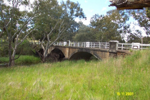
The Monier Bridge over the Wannon River at the township of Wannon, formerly Redruth, is the fourth bridge to span the river. The township developed around the crossing and in association…
-
MAJOR MITCHELL MEMORIAL AND WATER TROUGH
Glenelg Highway DUNKELD, Southern Grampians Shire

Southern Grampians Shire
The Major Mitchell Memorial in Dunkeld is located in the south west corner of a public reserve on the Glenelg Highway. It takes the form of an obelisk set on three stone blocks. The shaft is…
-
Turnbull Street COLERAINE, Southern Grampians Shire

Southern Grampians Shire
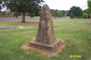
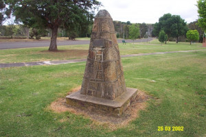
The Major Mitchell Monument is located in a small park on the north east corner of Turnbull and Henty Streets in Coleraine. The memorial takes the form of a tapering cairn constructed from…
-
Dartmoor/Hamilton Rd BRANXHOLME, Southern Grampians Shire

Southern Grampians Shire
The Ardachy Homestead Complex, eight kilometres north-west of Branxholme on the Dartmoor/Hamilton Road, consists of the ruins of the original homestead, its garden and associated works, a…
-
Nigretta Falls Road WANNON, Southern Grampians Shire

Southern Grampians Shire
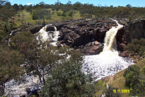
The Nigretta Falls Reserve is about 12.5kms north-west of Hamilton at the site of the former Nigretta Homestead overlooking the Wannon river. The total area now reserved is about 8 hectares…
-
Lake Linlithgow Road, WARRAYURE VIC 3301 - Property No 003

Southern Grampians Shire
AMENDMENT C6 - Place withdrawn from proposed Heritage Overlay - now considered of nil significance Walter Stephen Helpmann, a Warrnambool bank manager, almost certainly acting as a dummy for…
-
79-81 Wills Street, DUNKELD VIC 3294 - Property No 003

Southern Grampians Shire
Dunkeld Uniting Church, formerly Dunkeld Wesleyan and later, Dunkeld Methodist Church, is located on the south side of Wills Street in the centre of the township of Dunkeld. The brick…
-
COLERAINE BUTTER FACTORY (FORMER)
26 Robertson Street COLERAINE, Southern Grampians Shire

Southern Grampians Shire
The former Coleraine Butter Factory is an industrial complex situated in Robertson Street, on the eastern edge of the township of Coleraine. Its tall chimney stack is one of the most visible…
-
STATE SCHOOL NO. 4362 AND RESIDENCE (FORMER)
Zig Zag Road, KONONG WOOTONG NORTH VIC 3315 - Property No 124

Southern Grampians Shire
State School No. 4362, Zig Zag Road, Konongwootong North is a complex of timber buildings and gardens dating from 1929. The construction of the complex was triggered by the surge in…
-
Moree-Culla Road MOOREE, Southern Grampians Shire

Southern Grampians Shire
Gash's Dried Fruit Farm at Moree is a complex consisting of a 1930s homestead, with house garden and orchard, the remains of a once extensive commercial orchard, an early house site, and a…
-
MUDDY CREEK PIONEER MEMORIAL CHURCH
Church Road YULECART, Southern Grampians Shire

Southern Grampians Shire
The Muddy Creek Pioneer Memorial Church is located on the east side of Church Road in Yulecart. The church is a simple, loosely gothic style red pressed brick church which was built in 1929.…
