account anchor arrow-down arrow-left-thick arrow-right-solid arrow-right-thick arrow-right arrow-up audio bookmark-solid bookmark close compass dashboard delete download email explore hamburger help home image locate login marker-icon marker-multiple marker-single minus note options pause pdf play plus print refine search share shortlist signup skip sort-detail sort-image sort-list star tick timeline tour vhr welcome zoom
  • Home
  • Skip to content
  • Create account
  • Log in
Victorian Heritage Database
Search in:
  • Advanced places/objects search
  • Advanced shipwreck search
  • Search tips

Browse heritage places

  • and

Browse Shipwrecks

  • and
  • and

Browse Tours

  • Recommended tours
  • Contributed tours
  • Create your own tour
Account login
Create account

Browse heritage places

  • and

Browse Shipwrecks

  • and
  • and

Browse Tours

  • Recommended tours
  • Contributed tours
  • Create your own tour
Back to search
  • Save Search
    You must log in to do that.
  • Share Search
  • Download Search

    The download will only include records from the current search page. You can increase the number of records to download by changing the number of 'listings per page' at the bottom of this page. Note that the maximum number of records that can be listed per page is 300. The download may exceed the number of records listed as any 'nested' records that have met the search criteria will also download.

    Download file (.xls)
Search results:
Back to search

Refine results by

    • SOUTHERN GRAMPIANS SHIRE (43)
    • MERRI-BEK CITY (39)
    • GLENELG SHIRE (31)
    • MOONEE VALLEY CITY (26)
    • BOROONDARA CITY (17)
    • MELBOURNE CITY (15)
    • GREATER GEELONG CITY (12)
    • YARRA CITY (11)
    • HOBSONS BAY CITY (9)
    • MELTON CITY (9)
    • MOYNE SHIRE (9)
    • NILLUMBIK SHIRE (8)
    • BRIMBANK CITY (7)
    • MARIBYRNONG CITY (6)
    • MOORABOOL SHIRE (6)
    • BANYULE CITY (5)
    • MORNINGTON PENINSULA SHIRE (5)
    • STONNINGTON CITY (5)
    • COLAC OTWAY SHIRE (4)
    • CORANGAMITE SHIRE (4)
    • GOLDEN PLAINS SHIRE (3)
    • CARDINIA SHIRE (2)
    • HUME CITY (2)
    • PORT PHILLIP CITY (2)
    • PYRENEES SHIRE (2)
    • SOUTH GIPPSLAND SHIRE (2)
    • WELLINGTON SHIRE (2)
    • BAYSIDE CITY (2)
    • CASEY CITY (1)
    • DAREBIN CITY (1)
    • ALPINE SHIRE (1)
    • HEPBURN SHIRE (1)
    • HORSHAM RURAL CITY (1)
    • MACEDON RANGES SHIRE (1)
    • MANNINGHAM CITY (1)
    • MOIRA SHIRE (1)
    • MOUNT ALEXANDER SHIRE (1)
    • MURRINDINDI SHIRE (1)
    • BASS COAST SHIRE (1)
    • QUEENSCLIFFE BOROUGH (1)
    • STRATHBOGIE SHIRE (1)
    • SURF COAST SHIRE (1)
    • SWAN HILL RURAL CITY (1)
    • WEST WIMMERA SHIRE (1)
    • WHITTLESEA CITY (1)
    • WODONGA CITY (1)
    • Victorian Heritage Register (110)
    • Southern Grampians Shire (41)
    • Merri-bek City (37)
    • Moonee Valley City (26)
    • Glenelg Shire (20)
    • Boroondara City (13)
    • Hobsons Bay City (9)
    • Nillumbik Shire (8)
    • Melton City (7)
    • Yarra City (6)
    • Maribyrnong City (5)
    • Brimbank City (5)
    • Moorabool Shire (4)
    • Vic. War Heritage Inventory (4)
    • Stonnington City (3)
    • Cardinia Shire (2)
    • Darebin City (1)
    • South Gippsland Shire (1)
    • Banyule City (1)
    • Pre-separation Colonial Georgian 1836-50 (39)
    • Interwar Period (c.1919-c.1940) (33)
    • Pre-separation Colonial Vernacular 1836-50 (24)
    • Victorian Period (1851-1901) (17)
    • Interwar Period (c.1919-c.1940) Old English (13)
    • Interwar Period (c.1919-c.1940) American Bungalow (10)
    • Federation/Edwardian Period (1902-c.1918) (8)
    • Interwar Period (c.1919-c.1940) Moderne (7)
    • Federation/Edwardian Period (1902-c.1918) Domestic Queen Anne (5)
    • Victorian Period (1851-1901) Regency (4)
    • Victorian Period (1851-1901) Free Classical (2)
    • Federation/Edwardian Period (1902-c.1918) Bungalow (2)
    • Interwar Period (c.1919-c.1940) Stripped Classical (2)
    • Federation/Edwardian Period (1902-c.1918) Art-Nouveau (2)
    • Pre-separation Primitive Settlement 1788-1835 (1)
    • < - 1849 (303)
    • Registered place (137)
    • Registered archaeological place (21)
    • Registered object integral to a registered place (6)
    • Registered object (3)
    • Registered archaeological artefact (1)
    • 6. Building towns cities and the garden state (9)
      • 6.1 Establishing settlements in the Port Phillip District (5)
      • 6.2 Creating Melbourne (3)
      • 6.3 Shaping the suburbs (2)
      • 6.7 Making homes for Victorians (3)
    • 2. Peopling Victoria's places and landscapes (7)
      • 2.1 Living as Victoria's original inhabitants (1)
      • 2.2 Exploring surveying and mapping (1)
      • 2.3 Adapting to diverse environments (1)
      • 2.5 Migrating and making a home (3)
      • 2.6 Maintaining distinctive cultures (3)
      • 2.7 Promoting settlement (1)
      • 2.8 Fighting for identity (2)
    • 3. Connecting Victorians by transport and communications (5)
      • 3.1 Establishing pathways (2)
      • 3.2 Linking Victorians by water (1)
      • 3.3 Linking Victorians by rail (1)
      • 3.4 Linking Victorians by road in the 20th century (2)
      • 3.5 Travelling by tram (1)
      • 3.7 Establishing and maintaining communications (1)
    • 5. Building Victoria's industries and workforce (5)
      • 5.2 Developing a manufacturing capacity (1)
      • 5.3 Markets and retailing (1)
      • 5.5 Banking and finance (1)
      • 5.7 Catering for tourists (1)
      • 5.8 Working (1)
    • 4. Transforming and managing the land (3)
      • 4.3 Grazing and raising livestock (2)
      • 4.4 Farming (1)
    • 7. Governing Victorians (3)
      • 7.3 Maintaining law and order (1)
      • 7.4 Defending Victoria and Australia (2)
    • 8. Building community life (2)
      • 8.2 Educating people (1)
      • 8.3 Providing health and welfare services (2)
    • 9. Shaping cultural and creative life (2)
      • 9.1 Participating in sport and recreation (1)
      • 9.3 Achieving design and artistic distinction (1)
    • Residential buildings (private) (139)
      • House (78)
      • Homestead building (32)
      • Stables (16)
      • Cottage (15)
      • Shop (11)
      • Mansion (6)
      • Duplex (4)
      • Flat (4)
      • Fence/Wall (4)
      • Gatehouse (4)
      • Residential Precinct (4)
      • Hut/Shack (3)
      • Artefacts/Relics (3)
      • Residence (3)
      • Gate (2)
    • Farming and Grazing (80)
      • Homestead Complex (59)
      • Stables (16)
      • Woolshed/Shearing Shed (9)
      • Shed (7)
      • Staff quarters (5)
      • Gatehouse (4)
      • Pastoralism (4)
      • Shearers' Quarters (3)
      • Stockman's Hut (3)
      • Stone wall (3)
      • Barn (3)
      • Artefacts/Relics (3)
      • Sheep Dip/Sheep Wash (2)
      • Silo (2)
      • Stock Well/Tank (2)
      • Woolscour (2)
      • Warehouse/storage area (2)
      • Agriculture (2)
      • Farm (2)
      • Gate (2)
      • Kitchen (2)
      • Orchard (2)
      • Outstation (2)
      • Smoke House (1)
      • Yarding/ Loading Facility (1)
      • Abattoir/ Meat Processing (1)
    • Commercial (30)
      • House (78)
      • Hotel (17)
      • Stables (16)
      • Shop (11)
      • Inn/Tavern (7)
      • Staff quarters (5)
      • Commercial Precinct (4)
      • Office building (2)
      • Warehouse/storage area (2)
      • Bank (1)
    • Parks, Gardens and Trees (29)
      • House (78)
      • Garden Residential (10)
      • Planting exotic (9)
      • Lake/ Pond (4)
      • Statue (3)
      • Tree (3)
      • Tree groups - avenue (3)
      • Trees of social, historic or special significance (3)
      • Urban Park (2)
      • Gate (2)
    • Landscape - Cultural (20)
      • Historic Landscape (9)
      • Other - Landscape - Cultural (8)
      • Cultural Feature (3)
    • Religion (18)
      • Church (17)
      • Religious Objects (movable) (5)
      • Church Hall (3)
      • War Memorial (2)
      • Presbytery/Rectory/ Vicarage/Manse (2)
      • Sunday School (2)
    • Manufacturing and Processing (17)
      • Factory/ Plant (5)
      • Kiln Lime (3)
      • Fellmongery (2)
      • Other - Manufacturing & Processing (2)
      • Abattoir/ Meat Processing (1)
      • Blacksmith (1)
      • Kiln other (1)
      • Mill (Grain) (1)
      • Tannery (1)
    • Recreation and Entertainment (17)
      • House (78)
      • Hotel (17)
      • Inn/Tavern (7)
      • Art Gallery/ Museum (2)
    • Cemeteries and Burial Sites (15)
      • Cemetery/Graveyard/Burial Ground (11)
      • Isolated Grave/Burial Site (4)
      • Crematorium (2)
    • Transport - Road (9)
      • Stables (16)
      • Other - Transport - Road (4)
      • Road Bridge (2)
      • Trail/Track (2)
    • Military (7)
      • Stables (16)
      • Barracks & housing (2)
      • Battery (1)
      • Defence Base Naval (1)
      • Gun Emplacement (1)
      • Military Camp (1)
    • Education (7)
      • School - Private (3)
      • Office building (2)
      • Farm (2)
    • Retail and Wholesale (5)
      • House (78)
      • Shop (11)
      • Factory/ Plant (5)
    • Urban Area (5)
      • Mixed Use Precinct (4)
    • Aboriginal (5)
      • Post-contact Site (4)
      • Burial (2)
      • Historic site (2)
    • Government and Administration (5)
      • Staff quarters (5)
      • Customs House (2)
      • Office building (2)
      • Bond Store (1)
    • Law Enforcement (4)
      • Stables (16)
      • Staff Accommodation (2)
      • Police stables (2)
      • Court House (1)
      • Gaol/Lock-up (1)
    • Postal and Telecommunications (4)
      • Telegraph Station (2)
    • Transport - Water (4)
      • Lighthouse (2)
      • Wharf (2)
    • Mining and Mineral Processing (3)
      • Kiln Lime (3)
    • Exploration, Survey and Events (3)
      • Health Services (3)
        • Office building (2)
        • Hospital (2)
        • Leprosarium (2)
        • Quarantine Station (2)
        • Ambulance Station (1)
      • Monuments and Memorials (2)
        • Statue (3)
        • War Memorial (2)
      • Utilities - Electricity (2)
        • Transport - Rail (2)
          • Collections (2)
            • Community Objects (2)
          • Landscape - Natural (2)
            • Public Art (2)
              • Statue (3)
            • National Heritage Process Group (2)
              • Historic Heritage (2)
            • Maritime Industry (1)
              • Whaling Station (1)
            • Community Facilities (1)
              • House (78)
            • Heritage Inventory Site Type (1)
              • Unknown Item Group (1)

              Success

              Error

              Back to search
              • Save Search
                You must log in to do that.
              • Share Search
              • Download Search

                The download will only include records from the current search page. You can increase the number of records to download by changing the number of 'listings per page' at the bottom of this page. Note that the maximum number of records that can be listed per page is 300. The download may exceed the number of records listed as any 'nested' records that have met the search criteria will also download.

                Download file (.xls)
              Search results:
              Results filtered by: &lt; - 1849
              Displaying 126-150 of 299 records found 299 results
              Name, details and heritage listing
              Other authorities
              • PARK HILL (ORIGINAL SITE)

                Schuller's Road YULECART, Southern Grampians Shire

                Southern Grampians Shire

                Shortlist
                You must log in to shortlist items.
                Download

                The original homestead site of the Park Hill squatting run is located on the south side of the River Wannon approximately 14 kilometres west of Yulecart and 10 kilometres south-south-west of…

                Shortlist
                You must log in to shortlist items.
                Download
                 
              • WINNINBURN HOMESTEAD COMPLEX

                Heenan-Ferrier Road, TARRENLEA VIC 3315 - Property No 1573

                Southern Grampians Shire

                Shortlist
                You must log in to shortlist items.
                Download

                The squatting run Winninburn, as part of the Tahara run, was one of the earliest in the Portland Bay District, being taken up by George and Samuel Winter. The Winter brothers and the Whyte…

                Shortlist
                You must log in to shortlist items.
                Download
                 
              • KONGBOOL HOMESTEAD COMPLEX

                39 KONGBOOL ROAD BALMORAL, SOUTHERN GRAMPIANS SHIRE

                Southern Grampians Shire

                VHR H0361
                Shortlist
                You must log in to shortlist items.
                Download

                The 'Congbool' pastoral homestead on the Mathers Creek near Balmoral was first taken up by the Mather brothers in 1842. The original timber slab homestead of double hipped shingle roof,…

                Shortlist
                You must log in to shortlist items.
                Download
                 
              • ENGLEFIELD HOMESTEAD COMPLEX

                Natimuk - Hamilton Road, BALMORAL VIC 3407 - Property No 037

                Southern Grampians Shire

                Shortlist
                You must log in to shortlist items.
                Download

                The Englefield Homestead complex is located about 1.6kms south of Balmoral on a rise overlooking a creek which runs into the Glenelg River. The property straddles the Natimuk-Hamilton Road,…

                Shortlist
                You must log in to shortlist items.
                Download
                 
              • MOUNT NAPIER HOMESTEAD

                Harmans Road GAZETTE, Southern Grampians Shire

                Southern Grampians Shire

                Shortlist
                You must log in to shortlist items.
                Download

                The Mount Napier squatting run on the Eumerella River about twenty kilometres south-east of Hamilton and six kilometres from Mount Napier was taken up in 1840. The homestead complex has…

                Shortlist
                You must log in to shortlist items.
                Download
                 
              • SPRING VALE

                Hillview Road (Coleraine-Brit Brit Rd) COOJAR, Southern Grampians Shire

                Southern Grampians Shire

                Shortlist
                You must log in to shortlist items.
                Download

                The former Spring Vale homestead, located in Hillview Road, Coojar and overlooking Mather's Creek is a substantial complex developed in many distinct stages using a remarkable variety of…

                Shortlist
                You must log in to shortlist items.
                Download
                 
              • BLACKWOOD HOMESTEAD COMPLEX AND CEMETERY

                Blackwood-Dunkeld Rd PENSHURST, Southern Grampians Shire

                Southern Grampians Shire

                Shortlist
                You must log in to shortlist items.
                Download

                Blackwood Homestead Complex and Private Cemetery is located on the Dunkeld - Blackwood Road, eight kilometres north east of the township of Penshurst. The separate elements of this complex…

                Shortlist
                You must log in to shortlist items.
                Download
                 
              • MORGIANA HOMESTEAD COMPLEX

                Morgiana Road MORGIANA, Southern Grampians Shire

                Southern Grampians Shire

                Shortlist
                You must log in to shortlist items.
                Download

                Morgiana, located near the junction of the Grange Burn and the Wannon River, was settled as early as 1842 by Alexander Cameron and soon taken over by his nephew Donald Cameron. With other…

                Shortlist
                You must log in to shortlist items.
                Download
                 
              • VIOLET CREEK HOMESTEAD COMPLEX

                Hamilton-Dartmoor Road, YULECART VIC 3301 - Property No 031

                Southern Grampians Shire

                Shortlist
                You must log in to shortlist items.
                Download

                The Violet Creek Homestead Complex, Hamilton-Dartmoor Road, Yulecart, dates from 1843 when it was taken up by Angus Cameron. He was in partnership with a Donald Cameron in the later 1840s…

                Shortlist
                You must log in to shortlist items.
                Download
                 
              • WANNON FALLS GATES & RESERVE

                Glenelg Highway and Morgiana Road WANNON, Southern Grampians Shire

                Southern Grampians Shire

                Shortlist
                You must log in to shortlist items.
                Download

                The Wannon Falls Reserve is located on the south side of the Henty Highway, about 18kms north-west of Hamilton where the highway crosses the Wannon river. The total area reserved is about…

                Shortlist
                You must log in to shortlist items.
                Download
                 
              • KENILWORTH HOMESTEAD COMPLEX

                Cavendish-Coleraine Road, CAVENDISH VIC 3314 - Property No 002

                Southern Grampians Shire

                Shortlist
                You must log in to shortlist items.
                Download

                The Kenilworth squatting run located to the north-west of Cavendish at the junction of the Wannon and Dundas Rivers, was taken up in 1846 by Thomas Norris, of Kout Narien at Harrow. He sold…

                Shortlist
                You must log in to shortlist items.
                Download
                 
              • KANAWALLA HOMESTEAD COMPLEX

                Henty Highway, CAVENDISH VIC 3314 - Property No 062

                Southern Grampians Shire

                Shortlist
                You must log in to shortlist items.
                Download

                The Kanawalla squatting run, located on the Wannon River about 12 kms north of Hamilton, was taken up by George Duncan Lockhart in 1843 and was one of the largest in the Hamilton area. He…

                Shortlist
                You must log in to shortlist items.
                Download
                 
              • YAT NAT HOMESTEAD COMPLEX

                Yat Nat Road BALMORAL, Southern Grampians Shire

                Southern Grampians Shire

                Shortlist
                You must log in to shortlist items.
                Download

                Charles Sherratt (Sherrat or Sherret) and Alfred Betts took up the very large Yat Nat or Rocklands squatting run in July 1843. Its southern end was on the Glenelg River adjacent to Balmoral.…

                Shortlist
                You must log in to shortlist items.
                Download
                 
              • COLERAINE CEMETERY

                Lower Hilgay Road COLERAINE, Southern Grampians Shire

                Southern Grampians Shire

                Shortlist
                You must log in to shortlist items.
                Download

                The Coleraine Public Cemetery is located approximately 2.5 kilometers to the south west of the Town, on Lower Hilgay Road. This road was previously the access road to Hilgay Station, and the…

                Shortlist
                You must log in to shortlist items.
                Download
                 
              • FIGHTING WATERHOLES BURIAL SITE

                Konongwootong Reservoir KONONG WOOTONG, Southern Grampians Shire

                Southern Grampians Shire

                Shortlist
                You must log in to shortlist items.
                Download

                The Konongwootong Reservoir is the site of the previous chain of waterholes which were linked by Denhills Creek. It was here that in 1840, a hunting party of employees from nearby…

                Shortlist
                You must log in to shortlist items.
                Download
                 
              • DUNROE

                Hamilton-Port Fairy Road, BYADUK NORTH VIC 3300 - Property No 012

                Southern Grampians Shire

                Shortlist
                You must log in to shortlist items.
                Download

                Dunroe is a large two storey weather board house built in 1934 for Miss Lucy Carty (1886-1957), the daughter of local pastoralists Richard Thomas and Lucy Carty, nee Hawkins who occupied…

                Shortlist
                You must log in to shortlist items.
                Download
                 
              • ROCKLANDS ROAD FORD

                Rocklands Road BALMORAL, Southern Grampians Shire

                Southern Grampians Shire

                Shortlist
                You must log in to shortlist items.
                Download

                The Rocklands Road ford is located across the Glenelg River below the Woodlands Homestead, on what was previously the main road between Adelaide and Melbourne, via Horsham. It is a low wall…

                Shortlist
                You must log in to shortlist items.
                Download
                 
              • WOODLANDS WOOLSCOUR (FORMER)

                Rocklands Road BALMORAL, Southern Grampians Shire

                Southern Grampians Shire

                Shortlist
                You must log in to shortlist items.
                Download

                The site of the former Woodlands Woolscour is located on the north side Rocklands Road, on the bank of the Glenelg River. The site has a piece of equipment, apparently a steam engine located…

                Shortlist
                You must log in to shortlist items.
                Download
                 
              • WOOLPRESS TREE

                Sierra Park Victoria Valley Road VICTORIA VALLEY, Southern Grampians Shire

                Southern Grampians Shire

                Shortlist
                You must log in to shortlist items.
                Download

                The Woolpress Tree is located on the mosdern property, Sierra Park Sheep Stud which was originally part of the very early squatting lease, Victoria Valley. The age of the tree, which is…

                Shortlist
                You must log in to shortlist items.
                Download
                 
              • MAJOR MITCHELL'S TRACK AND BLAZED TREE

                Woodacres Lane NAREEN, Southern Grampians Shire

                Southern Grampians Shire

                Shortlist
                You must log in to shortlist items.
                Download

                The site known as Major Mitchell's Track is located on private property 'Cuyuac', in a paddock on the east side of Woodacres Lane. It is approximately 4.5kms north-west of its intersection…

                Shortlist
                You must log in to shortlist items.
                Download
                 
              • VICTORIA LAGOON GRAVES

                Oakley's Road MOORALLA, Southern Grampians Shire

                Southern Grampians Shire

                Shortlist
                You must log in to shortlist items.
                Download

                The Victoria Lagoon squatting run, located approximately 20kms north-east of Cavendish on the edge of a natural water feature, was taken up by Peter Parton in 1845. It was then taken over by…

                Shortlist
                You must log in to shortlist items.
                Download
                 
              • BUSHY CREEK HOMESTEAD COMPLEX

                Bushy Creek Lane GLENTHOMPSON, Southern Grampians Shire

                Southern Grampians Shire

                Shortlist
                You must log in to shortlist items.
                Download

                The Bushy Creek Homestead is a asymmetrical single storey house built of concrete blocks with a substantial timber verandah on three sides. The floor plan is irregular, partly because an…

                Shortlist
                You must log in to shortlist items.
                Download
                 
              • BRIE BRIE HOMESTEAD COMPLEX

                Bundoran Road GLENTHOMPSON, Southern Grampians Shire

                Southern Grampians Shire

                Shortlist
                You must log in to shortlist items.
                Download

                John Marr, William P. Scott and Charles Gray took up the Green Hill Creek squatting run, at Lake Repose in 1840. Scott soon left the partnership and Green Hill Creek was subdivided in 1846,…

                Shortlist
                You must log in to shortlist items.
                Download
                 
              • WOODHOUSE HOMESTEAD COMPLEX

                Woodhouse Lane WOODHOUSE, Southern Grampians Shire

                Southern Grampians Shire

                Shortlist
                You must log in to shortlist items.
                Download

                The Woodhouse Homestead Complex is located in the north-west corner of the intersection of the Hamilton-Chatsworth Road and Woodhouse Lane about 12kms north-east of Mount Rouse. It is at the…

                Shortlist
                You must log in to shortlist items.
                Download
                 
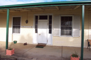
              • MOUNT KOROITE HOMESTEAD (ORIGINAL SITE)

                Heffernan Lane COLERAINE, Southern Grampians Shire

                Southern Grampians Shire

                Shortlist
                You must log in to shortlist items.
                Download

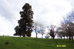
                The original site of Mount Koroite Homestead is located about eight kilometers east of the township of Coleraine, and north of the second homestead, which is located at the top of the hill.…
                Shortlist
                You must log in to shortlist items.
                Download
                 
              • ‹
              • 1
              • 2
              • 3
              • 4
              • 5
              • 6
              • 7
              • 8
              • 9
              • 10
              • 11
              • 12
              • ›
              Account login
              Create account

              The Victorian Heritage Database is a searchable database containing information about thousands of heritage places and objects in Victoria. It includes entries for around 2400 places and objects of state significance listed in the Victorian Heritage Register as well as many places of archaeological interest included in the Victorian Heritage Inventory. Most of the database entries are local heritage places, listed on the heritage overlay from 29 local governments (out of 79 LGAs in the state). Information on heritage places from the National Trust and Victorian War Heritage Inventory is also included. Learn more.

              State Government Victoria
              • Home
              • Advanced search
              • Account login
              • Heritage Council of Victoria
              • Heritage Victoria
              • Contact us
              • Copyright disclaimer
              • Privacy statement
              • Terms & Conditions
              • Accessibility statement
              • API
              Digital Agency - Calico

              You need to be logged into to perform this action. Please login here.