-
Save Search
You must log in to do that.
-
Share Search
-
Download Search
The download will only include records from the current search page. You can increase the number of records to download by changing the number of 'listings per page' at the bottom of this page. Note that the maximum number of records that can be listed per page is 300. The download may exceed the number of records listed as any 'nested' records that have met the search criteria will also download.
Download file (.xls)
Success
Error
-
Save Search
You must log in to do that.
-
Share Search
-
Download Search
The download will only include records from the current search page. You can increase the number of records to download by changing the number of 'listings per page' at the bottom of this page. Note that the maximum number of records that can be listed per page is 300. The download may exceed the number of records listed as any 'nested' records that have met the search criteria will also download.
Download file (.xls)
-
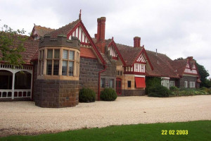
4876 Glenelg Highway, CARAPOOK VIC 3312 - Property No 1010724

Southern Grampians Shire
VHR H0294Muntham Homestead Complex is located on the Glenelg Highway approximately 15kms north-west of Coleraine on the side of Muntham Hill overlooking the valley of the Wennicot Creek. The…
-
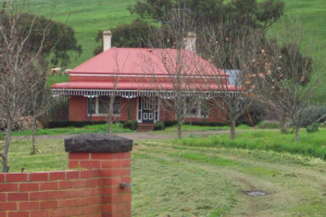
MONIVAE HOMESTEAD ORIGINAL SITE
Port Fairy-Hamilton Road HAMILTON, Southern Grampians Shire

Southern Grampians Shire
The original Monivae homestead site is located 2kms south of Hamilton, immediately adjacent to the Hamilton-Port Fairy Road and on the Muddy Creek. The squatting run was taken up by Acheson…
-
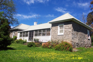
MURNDAL HOMESTEAD COMPLEX AND CEMETERY
Murndal Road, TAHARA VIC 3301 - Property No 2021400

Southern Grampians Shire
VHR H0289(Taken from the Victorian Heritage Register) Murndal is at the heart of a pastoral run formerly known as Spring Valley, which was initially part of a larger squatting run called Tahara.…
-
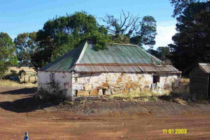
Wilderness Road, GRITJURK VIC 3315 - Property No 151

Southern Grampians Shire
The Wilderness Homestead complex is in two parts: the original site which is close to the woolshed and overlooks a branch of the Bryant's Creek valley, and the present site which is on…
-
Hilgay Road COLERAINE, Southern Grampians Shire

Southern Grampians Shire
The substantial remains of Hilgay Station are located behind a modern house at the intersection (and termination) of the Top and Lower Hilgay Road immediately south of the intersection with…
-
Schuller's Road YULECART, Southern Grampians Shire

Southern Grampians Shire
The original homestead site of the Park Hill squatting run is located on the south side of the River Wannon approximately 14 kilometres west of Yulecart and 10 kilometres south-south-west of…
-
Heenan-Ferrier Road, TARRENLEA VIC 3315 - Property No 1573

Southern Grampians Shire
The squatting run Winninburn, as part of the Tahara run, was one of the earliest in the Portland Bay District, being taken up by George and Samuel Winter. The Winter brothers and the Whyte…
-
39 KONGBOOL ROAD BALMORAL, SOUTHERN GRAMPIANS SHIRE

Southern Grampians Shire
VHR H0361The 'Congbool' pastoral homestead on the Mathers Creek near Balmoral was first taken up by the Mather brothers in 1842. The original timber slab homestead of double hipped shingle roof,…
-
Natimuk - Hamilton Road, BALMORAL VIC 3407 - Property No 037

Southern Grampians Shire
The Englefield Homestead complex is located about 1.6kms south of Balmoral on a rise overlooking a creek which runs into the Glenelg River. The property straddles the Natimuk-Hamilton Road,…
-
Harmans Road GAZETTE, Southern Grampians Shire

Southern Grampians Shire
The Mount Napier squatting run on the Eumerella River about twenty kilometres south-east of Hamilton and six kilometres from Mount Napier was taken up in 1840. The homestead complex has…
-
Hillview Road (Coleraine-Brit Brit Rd) COOJAR, Southern Grampians Shire

Southern Grampians Shire
The former Spring Vale homestead, located in Hillview Road, Coojar and overlooking Mather's Creek is a substantial complex developed in many distinct stages using a remarkable variety of…
-
BLACKWOOD HOMESTEAD COMPLEX AND CEMETERY
Blackwood-Dunkeld Rd PENSHURST, Southern Grampians Shire

Southern Grampians Shire
Blackwood Homestead Complex and Private Cemetery is located on the Dunkeld - Blackwood Road, eight kilometres north east of the township of Penshurst. The separate elements of this complex…
-
Morgiana Road MORGIANA, Southern Grampians Shire

Southern Grampians Shire
Morgiana, located near the junction of the Grange Burn and the Wannon River, was settled as early as 1842 by Alexander Cameron and soon taken over by his nephew Donald Cameron. With other…
-
VIOLET CREEK HOMESTEAD COMPLEX
Hamilton-Dartmoor Road, YULECART VIC 3301 - Property No 031

Southern Grampians Shire
The Violet Creek Homestead Complex, Hamilton-Dartmoor Road, Yulecart, dates from 1843 when it was taken up by Angus Cameron. He was in partnership with a Donald Cameron in the later 1840s…
-
Glenelg Highway and Morgiana Road WANNON, Southern Grampians Shire

Southern Grampians Shire
The Wannon Falls Reserve is located on the south side of the Henty Highway, about 18kms north-west of Hamilton where the highway crosses the Wannon river. The total area reserved is about…
-
Cavendish-Coleraine Road, CAVENDISH VIC 3314 - Property No 002

Southern Grampians Shire
The Kenilworth squatting run located to the north-west of Cavendish at the junction of the Wannon and Dundas Rivers, was taken up in 1846 by Thomas Norris, of Kout Narien at Harrow. He sold…
-
Henty Highway, CAVENDISH VIC 3314 - Property No 062

Southern Grampians Shire
The Kanawalla squatting run, located on the Wannon River about 12 kms north of Hamilton, was taken up by George Duncan Lockhart in 1843 and was one of the largest in the Hamilton area. He…
-
Yat Nat Road BALMORAL, Southern Grampians Shire

Southern Grampians Shire
Charles Sherratt (Sherrat or Sherret) and Alfred Betts took up the very large Yat Nat or Rocklands squatting run in July 1843. Its southern end was on the Glenelg River adjacent to Balmoral.…
-
Lower Hilgay Road COLERAINE, Southern Grampians Shire

Southern Grampians Shire
The Coleraine Public Cemetery is located approximately 2.5 kilometers to the south west of the Town, on Lower Hilgay Road. This road was previously the access road to Hilgay Station, and the…
-
FIGHTING WATERHOLES BURIAL SITE
Konongwootong Reservoir KONONG WOOTONG, Southern Grampians Shire

Southern Grampians Shire
The Konongwootong Reservoir is the site of the previous chain of waterholes which were linked by Denhills Creek. It was here that in 1840, a hunting party of employees from nearby…
-
Hamilton-Port Fairy Road, BYADUK NORTH VIC 3300 - Property No 012

Southern Grampians Shire
Dunroe is a large two storey weather board house built in 1934 for Miss Lucy Carty (1886-1957), the daughter of local pastoralists Richard Thomas and Lucy Carty, nee Hawkins who occupied…
-
Rocklands Road BALMORAL, Southern Grampians Shire

Southern Grampians Shire
The Rocklands Road ford is located across the Glenelg River below the Woodlands Homestead, on what was previously the main road between Adelaide and Melbourne, via Horsham. It is a low wall…
-
Rocklands Road BALMORAL, Southern Grampians Shire

Southern Grampians Shire
The site of the former Woodlands Woolscour is located on the north side Rocklands Road, on the bank of the Glenelg River. The site has a piece of equipment, apparently a steam engine located…
-
Sierra Park Victoria Valley Road VICTORIA VALLEY, Southern Grampians Shire

Southern Grampians Shire
The Woolpress Tree is located on the mosdern property, Sierra Park Sheep Stud which was originally part of the very early squatting lease, Victoria Valley. The age of the tree, which is…
-
MAJOR MITCHELL'S TRACK AND BLAZED TREE
Woodacres Lane NAREEN, Southern Grampians Shire

Southern Grampians Shire
The site known as Major Mitchell's Track is located on private property 'Cuyuac', in a paddock on the east side of Woodacres Lane. It is approximately 4.5kms north-west of its intersection…
