account anchor arrow-down arrow-left-thick arrow-right-solid arrow-right-thick arrow-right arrow-up audio bookmark-solid bookmark close compass dashboard delete download email explore hamburger help home image locate login marker-icon marker-multiple marker-single minus note options pause pdf play plus print refine search share shortlist signup skip sort-detail sort-image sort-list star tick timeline tour vhr welcome zoom
  • Home
  • Skip to content
  • Create account
  • Log in
Victorian Heritage Database
Search in:
  • Advanced places/objects search
  • Advanced shipwreck search
  • Search tips

Browse heritage places

  • and

Browse Shipwrecks

  • and
  • and

Browse Tours

  • Recommended tours
  • Contributed tours
  • Create your own tour
Account login
Create account

Browse heritage places

  • and

Browse Shipwrecks

  • and
  • and

Browse Tours

  • Recommended tours
  • Contributed tours
  • Create your own tour
Back to search
  • Save Search
    You must log in to do that.
  • Share Search
  • Download Search

    The download will only include records from the current search page. You can increase the number of records to download by changing the number of 'listings per page' at the bottom of this page. Note that the maximum number of records that can be listed per page is 300. The download may exceed the number of records listed as any 'nested' records that have met the search criteria will also download.

    Download file (.xls)
Search results:
Back to search

Refine results by

    • SOUTHERN GRAMPIANS SHIRE (151)
    • Southern Grampians Shire (151)
    • Federation/Edwardian Period (1902-c.1918) Domestic Queen Anne (10)
    • Federation/Edwardian Period (1902-c.1918) Bungalow (7)
    • Pre-separation Colonial Vernacular 1836-50 (7)
    • Interwar Period (c.1919-c.1940) American Bungalow (5)
    • Pre-separation Colonial Georgian 1836-50 (3)
    • Victorian Period (1851-1901) Free Classical (2)
    • Federation/Edwardian Period (1902-c.1918) Free Classical (2)
    • Victorian Period (1851-1901) Renaissance Revival (1)
    • Mid-Twentieth Century (1940-60) Structuralist (1)
    • Interwar Period (c.1919-c.1940) Georgian Revival (1)
    • Mid-Twentieth Century (1940-60) International (1)
    • Mid-Twentieth Century (1940-60) Austerity (1)
    • Victorian Period (1851-1901) English Queen Anne Revival (1)
    • Late Twentieth Century (c.1960-c.2000) International (1)
    • Victorian Period (1851-1901) Regency (1)
    • 1850 - 1879 (68)
    • < - 1849 (28)
    • 1880 - 1909 (24)
    • 1910 - 1939 (16)
    • 1940 - 1969 (3)
    • Registered place (120)
    • Registered archaeological place (3)
    • Farming and Grazing (151)
      • Homestead Complex (117)
      • Woolshed/Shearing Shed (15)
      • Farm (12)
      • Apiculture/beekeeping (4)
      • Orchard (4)
      • Sheep Dip/Sheep Wash (3)
      • Outstation (3)
      • Shearers' Quarters (2)
      • Stables (2)
      • Staff quarters (2)
      • Agriculture (2)
      • Animal Husbandry (2)
      • Barn (2)
      • Dairy (2)
      • Horticulture (2)
      • Shed (1)
      • Vineyard/Winery (1)
      • Woolscour (1)
      • Yarding/ Loading Facility (1)
      • Warehouse/storage area (1)
      • Fence (1)
      • Other - Farming & Grazing (1)
      • Flour Mill (1)
      • Fruit Shed/Apple store (1)
      • Pastoralism (1)
    • Parks, Gardens and Trees (20)
      • Garden Residential (11)
      • Trees of social, historic or special significance (3)
      • Garden House (2)
      • House (2)
      • Bandstand/Rotunda (1)
      • Planting exotic (1)
      • Planting groups (1)
      • Tree (1)
      • Tree groups - avenue (1)
    • Landscape - Cultural (10)
      • Historic Landscape (9)
      • Other - Landscape - Cultural (1)
    • Cemeteries and Burial Sites (5)
      • Cemetery/Graveyard/Burial Ground (3)
      • Isolated Grave/Burial Site (2)
    • Residential buildings (private) (5)
      • Stables (2)
      • Homestead building (2)
      • House (2)
      • Hut/Shack (1)
      • Mansion (1)
    • Manufacturing and Processing (3)
      • Sawmill (1)
      • Fellmongery (1)
      • Other - Manufacturing & Processing (1)
      • Flour Mill (1)
    • Education (3)
      • Farm (12)
      • School - State (public) (2)
      • School - Private (1)
    • Commercial (2)
      • Stables (2)
      • Staff quarters (2)
      • House (2)
      • Warehouse/storage area (1)
      • Hotel (1)
    • Postal and Telecommunications (1)
      • Post Office (1)
    • Community Facilities (1)
      • House (2)
      • Hall Public (1)
    • Transport - Air (1)
      • Aircraft Hanger (1)
    • Transport - Rail (1)
      • Railway gate/ fence/ wall, (1)
    • Exploration, Survey and Events (1)
      • Exploration Route (1)
    • Forestry and Timber Industry (1)
      • House (2)
      • Sawmill (1)
    • Government and Administration (1)
      • Staff quarters (2)
      • Other - Government & Administration (1)

Success

Error

Back to search
  • Save Search
    You must log in to do that.
  • Share Search
  • Download Search

    The download will only include records from the current search page. You can increase the number of records to download by changing the number of 'listings per page' at the bottom of this page. Note that the maximum number of records that can be listed per page is 300. The download may exceed the number of records listed as any 'nested' records that have met the search criteria will also download.

    Download file (.xls)
Search results:
Results filtered by: Southern Grampians Shire Farming and Grazing SOUTHERN GRAMPIANS SHIRE
Displaying 1-25 of 151 records found 151 results
Name, details and heritage listing
Other authorities
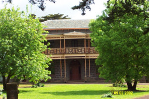
  • MUNTHAM HOMESTEAD COMPLEX

    4876 Glenelg Highway, CARAPOOK VIC 3312 - Property No 1010724

    Southern Grampians Shire

    VHR H0294
    Shortlist
    You must log in to shortlist items.
    Download

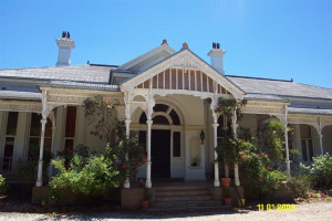
    Muntham Homestead Complex is located on the Glenelg Highway approximately 15kms north-west of Coleraine on the side of Muntham Hill overlooking the valley of the Wennicot Creek. The…

    Shortlist
    You must log in to shortlist items.
    Download
     
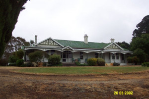
  • WANNON LEA GARDEN & ORCHARD

    RMB 8720 Morgiana Road, WANNON VIC 3301 - Property No 2021200

    Southern Grampians Shire

    Shortlist
    You must log in to shortlist items.
    Download

    The garden and orchard of Wannon Lea surround a typical early late nineteenth or early twentieth century weatherboard farmhouse. The garden is sited adjacent to the Morgiana Road,…

    Shortlist
    You must log in to shortlist items.
    Download
     
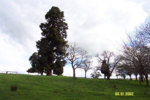
  • MONIVAE

    Hamilton-Port Fairy Road HAMILTON, Southern Grampians Shire

    Southern Grampians Shire

    Shortlist
    You must log in to shortlist items.
    Download

    Monivae Homestead, the second property by that name, is located two kilometres south of Hamilton on the Hamilton-Port Fairy Road on the Muddy Creek and beside the Hamilton-Portland railway…

    Shortlist
    You must log in to shortlist items.
    Download
     
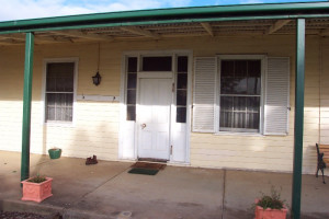
  • WILDERNESS HOMESTEAD COMPLEX

    Wilderness Road, GRITJURK VIC 3315 - Property No 151

    Southern Grampians Shire

    Shortlist
    You must log in to shortlist items.
    Download

    The Wilderness Homestead complex is in two parts: the original site which is close to the woolshed and overlooks a branch of the Bryant's Creek valley, and the present site which is on…

    Shortlist
    You must log in to shortlist items.
    Download
     
  • CUYUAC HOMESTEAD COMPLEX

    Chetwynd-Nareen Road, NAREEN VIC 3315 - Property No 144

    Southern Grampians Shire

    Shortlist
    You must log in to shortlist items.
    Download

    The Cuyuac Homestead complex is located approximately six kilometers west of the village of Nareen, one and a half kilometers south of the Chetwynd-Nareen Road, overlooking Webb's Creek. The…

    Shortlist
    You must log in to shortlist items.
    Download
     
  • TULSE HILL

    Carapook Road, CARAPOOK VIC 3312 - Property No 115

    Southern Grampians Shire

    Shortlist
    You must log in to shortlist items.
    Download

    Tulse Hill is a homestead complex located on the Carapook Road, near the small settlement of Carapook, 15kms northwest of Coleraine. The complex includes the house and garden, mature trees…

    Shortlist
    You must log in to shortlist items.
    Download
     
  • HILGAY STATION (FORMER)

    Hilgay Road COLERAINE, Southern Grampians Shire

    Southern Grampians Shire

    Shortlist
    You must log in to shortlist items.
    Download

    The substantial remains of Hilgay Station are located behind a modern house at the intersection (and termination) of the Top and Lower Hilgay Road immediately south of the intersection with…

    Shortlist
    You must log in to shortlist items.
    Download
     
  • PARK HILL (SECOND SITE)

    Falkenburg's Road, WANNON VIC 3301 - Property No 154

    Southern Grampians Shire

    Shortlist
    You must log in to shortlist items.
    Download

    The second site for the Park Hill homestead was developed in 1912, high on the opposite bank of the River Wannon from the original site which was low and damp. It is located at the southern…

    Shortlist
    You must log in to shortlist items.
    Download
     
  • PARK HILL (ORIGINAL SITE)

    Schuller's Road YULECART, Southern Grampians Shire

    Southern Grampians Shire

    Shortlist
    You must log in to shortlist items.
    Download

    The original homestead site of the Park Hill squatting run is located on the south side of the River Wannon approximately 14 kilometres west of Yulecart and 10 kilometres south-south-west of…

    Shortlist
    You must log in to shortlist items.
    Download
     
  • SATIMER HOMESTEAD COMPLEX

    Wando Dale-Satimer Road, NAREEN VIC 3315 - Property No 146

    Southern Grampians Shire

    Shortlist
    You must log in to shortlist items.
    Download

    The Satimer Homestead Complex is located approximately 100 metres north of the Satimer-Wando Vale Road, overlooking the Wando River. The original homestead has been demolished, although…

    Shortlist
    You must log in to shortlist items.
    Download
     
  • WINNINBURN HOMESTEAD COMPLEX

    Heenan-Ferrier Road, TARRENLEA VIC 3315 - Property No 1573

    Southern Grampians Shire

    Shortlist
    You must log in to shortlist items.
    Download

    The squatting run Winninburn, as part of the Tahara run, was one of the earliest in the Portland Bay District, being taken up by George and Samuel Winter. The Winter brothers and the Whyte…

    Shortlist
    You must log in to shortlist items.
    Download
     
  • WILLAROO

    Nareen-Coleraine Road NAREEN, Southern Grampians Shire

    Southern Grampians Shire

    Shortlist
    You must log in to shortlist items.
    Download

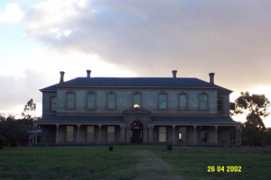
    Willaroo is a large single storey rendered brick house situated in an extensive landscaped garden. The house is approached by a long winding drive, which crosses Corea Creek, and rises…

    Shortlist
    You must log in to shortlist items.
    Download
     
  • KONGBOOL HOMESTEAD COMPLEX

    39 KONGBOOL ROAD BALMORAL, SOUTHERN GRAMPIANS SHIRE

    Southern Grampians Shire

    VHR H0361
    Shortlist
    You must log in to shortlist items.
    Download

    The 'Congbool' pastoral homestead on the Mathers Creek near Balmoral was first taken up by the Mather brothers in 1842. The original timber slab homestead of double hipped shingle roof,…

    Shortlist
    You must log in to shortlist items.
    Download
     
  • ENGLEFIELD HOMESTEAD COMPLEX

    Natimuk - Hamilton Road, BALMORAL VIC 3407 - Property No 037

    Southern Grampians Shire

    Shortlist
    You must log in to shortlist items.
    Download

    The Englefield Homestead complex is located about 1.6kms south of Balmoral on a rise overlooking a creek which runs into the Glenelg River. The property straddles the Natimuk-Hamilton Road,…

    Shortlist
    You must log in to shortlist items.
    Download
     
  • KOLOR HOMESTEAD COMPLEX

    Penshurst-Warrnmabool Road, PENSHURST VIC 3289 - Property No 001

    Southern Grampians Shire

    VHR H0541
    Shortlist
    You must log in to shortlist items.
    Download

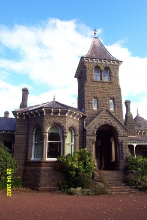
    The Kolor Homestead complex is located on the western shoulder of Mount Rouse, some three kilometres south of the township of Penshurst. The complex consists of a large picturesque bluestone…

    Shortlist
    You must log in to shortlist items.
    Download
     
  • KOLOR WOOLSHED (Former)

    Penshurst -Warrnambool Rd, PENSHURST VIC 3289 - Property No 001

    Southern Grampians Shire

    VHR H0324
    Shortlist
    You must log in to shortlist items.
    Download

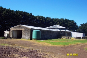
    The former Kolor Woolshed is located a property named Terringa, some six kilometres south of the township of Penshurst. The land on which it stands was formerly part of John Twomey's Kolor,…

    Shortlist
    You must log in to shortlist items.
    Download
     
  • THE GUMS

    Woolsthorpe Road, PENSHURST VIC 3289 - Property No 0001

    Southern Grampians Shire

    Shortlist
    You must log in to shortlist items.
    Download

    The Gums Homestead Complex is located 12 kilometres east of Penshurst, on the Woolsthorpe Road. There are two surviving homesteads dating from 1852 and 1876, and the potential archaeological…

    Shortlist
    You must log in to shortlist items.
    Download
     
  • MOUNT NAPIER HOMESTEAD

    Harmans Road GAZETTE, Southern Grampians Shire

    Southern Grampians Shire

    Shortlist
    You must log in to shortlist items.
    Download

    The Mount Napier squatting run on the Eumerella River about twenty kilometres south-east of Hamilton and six kilometres from Mount Napier was taken up in 1840. The homestead complex has…

    Shortlist
    You must log in to shortlist items.
    Download
     
  • GAZETTE HOMESTEAD COMPLEX

    Macarthur-Penshurst Rd GAZETTE, Southern Grampians Shire

    Southern Grampians Shire

    Shortlist
    You must log in to shortlist items.
    Download

    The present Gazette Homestead complex is located about 10kms south-west of Penshurst, on the edge of the lava flow from Mount Rouse and on the Eumeralla River. The squatting run called…

    Shortlist
    You must log in to shortlist items.
    Download
     
  • KILMUIR

    Nareen Road NAREEN, Southern Grampians Shire

    Southern Grampians Shire

    Shortlist
    You must log in to shortlist items.
    Download

    Kilmuir is a stone cottage located in Nareen Road about one kilometre south of Nareen. It seems to have been built in the 1860s as a result of the subdivision of land under the Land…

    Shortlist
    You must log in to shortlist items.
    Download
     
  • POST AND RAIL FENCES

    Glenelg Highway BOCHARA, Southern Grampians Shire

    Southern Grampians Shire

    Shortlist
    You must log in to shortlist items.
    Download

    The Post and Rail Fences located along the Glenelg Highway at Bochara are the only physical fabric remaining of the Bochara Station, which was opened as part of the Hamilton - Coleraine line…

    Shortlist
    You must log in to shortlist items.
    Download
     
  • GRINGEGALGONA

    Gringe Dip Road, GRINGEGALGONA VIC 3315 - Property No 147

    Southern Grampians Shire

    VHR H1925
    Shortlist
    You must log in to shortlist items.
    Download

    The present Gringegalgona homestead was built for Duncan Robertson, a successful Western District pastoralist who acquired the Gringegalgona pastoral run with about 40,000 acres in c1861.…

    Shortlist
    You must log in to shortlist items.
    Download
     
  • GLENISLA HOMESTEAD COMPLEX

    Henty Highway, GLENISLA VIC 3408 - Property No 049

    Southern Grampians Shire

    VHR H0444
    Shortlist
    You must log in to shortlist items.
    Download

    Glenisla squatting run was established in 1843 by a Scotsman named Simpson who named the run after a kirkdom near Balmoral. In 1860 Charles Carter and Sons acquired the run. From the 1870s…

    Shortlist
    You must log in to shortlist items.
    Download
     
  • STONE COTTAGE (NAREEN)

    Nareen-Chetwynd Rd NAREEN, Southern Grampians Shire

    Southern Grampians Shire

    Shortlist
    You must log in to shortlist items.
    Download

    The stone cottage and remnant garden is located approximately 500 metres south west of the intersection of the Chetwynd-Nareen Road and the Nareen Road, near the hamlet of Nareen. The…

    Shortlist
    You must log in to shortlist items.
    Download
     
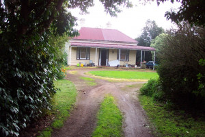
  • SPRING VALE

    Hillview Road (Coleraine-Brit Brit Rd) COOJAR, Southern Grampians Shire

    Southern Grampians Shire

    Shortlist
    You must log in to shortlist items.
    Download

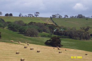
    The former Spring Vale homestead, located in Hillview Road, Coojar and overlooking Mather's Creek is a substantial complex developed in many distinct stages using a remarkable variety of…
    Shortlist
    You must log in to shortlist items.
    Download
     
  • ‹
  • 1
  • 2
  • 3
  • 4
  • 5
  • 6
  • 7
  • ›
Account login
Create account

The Victorian Heritage Database is a searchable database containing information about thousands of heritage places and objects in Victoria. It includes entries for around 2400 places and objects of state significance listed in the Victorian Heritage Register as well as many places of archaeological interest included in the Victorian Heritage Inventory. Most of the database entries are local heritage places, listed on the heritage overlay from 29 local governments (out of 79 LGAs in the state). Information on heritage places from the National Trust and Victorian War Heritage Inventory is also included. Learn more.

State Government Victoria
  • Home
  • Advanced search
  • Account login
  • Heritage Council of Victoria
  • Heritage Victoria
  • Contact us
  • Copyright disclaimer
  • Privacy statement
  • Terms & Conditions
  • Accessibility statement
  • API
Digital Agency - Calico

You need to be logged into to perform this action. Please login here.